This item has been sold, but you can get on the Waitlist to be notified if another example becomes available, or purchase a digital scan.
1855 Public Survey Map of Michigan
Michigan-landoffice-1855$125.00

Title
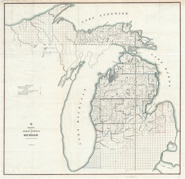
B Sketch of the Public Survey in Michigan.
1855 (undated) 22 x 22 in (55.88 x 55.88 cm)
1855 (undated) 22 x 22 in (55.88 x 55.88 cm)
Description
This is an attractive example of the 1855 public survey map of Michigan. It covers the entire state of Michigan from Lake Superior to Lake Erie, including the entirety of Lake Michigan. The state of the Land Survey in this region is illustrated via a series of square plats representing the survey grid. A key near the left border offers an explanation of the markings in the survey plats. Numerous rivers and islands and other geographical features are noted. This map was printed by C. B. Graham.
Cartographer
The General Land Office (1812 - 1946) was an independent agency charged with the administration and sale of public lands of the western territories of the United States under the Preemption Act of 1841 and the Homestead Act of 1862. During a time of frenetic energy and rapid westward expansion, the Land Office oversaw the surveying, platting, mapping and eventually the sale of much of the Western United States and Florida. The structural layout of the western United States that we see today, and many of their district and county divisions, are direct result of the early surveying work of the General Land Office. More importantly, as a branch of the Federal Government in Washington D.C. and the only agency able to legally sell and administer public lands in the western territories of the United States, the General Land Office played a pivotal role in consolidating power away from the original states and into the hands of the centralized federal government. The General Land Office was absorbed into the Department of Interior in 1849 and in 1946 merged with the United States Grazing Service to become the Bureau of Land Management. Today the Bureau of Land Management administers the roughly 246 million acres of public land remaining under federal ownership. More by this mapmaker...
Condition
Very good. Minor wear along original fold lines. Minor spotting. Professionally flattened and backed with archival tissue.