Digital Image: 1950 National Survey Company Map of Mount Desert Island, Maine
MountDesertIsland-nationalsurveyco-1950_d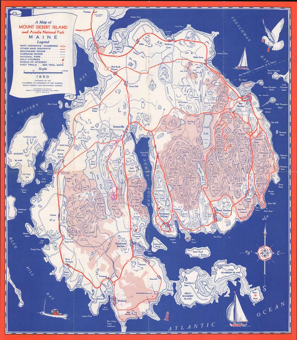

Title
A Map of Mount Desert Island and Acadia National Park Maine.
1950 (dated) 17.75 x 15.75 in (45.085 x 40.005 cm) 1 : 56320
1950 (dated) 17.75 x 15.75 in (45.085 x 40.005 cm) 1 : 56320
Description
FOR THE ORIGINAL ANTIQUE MAP, WITH HISTORICAL ANALYSIS, CLICK HERE.
Digital Map Information
Geographicus maintains an archive of high-resolution rare map scans. We scan our maps at 300 DPI or higher, with newer images being 600 DPI, (either TIFF or JPEG, depending on when the scan was done) which is most cases in suitable for enlargement and printing.
Delivery
Once you purchase our digital scan service, you will receive a download link via email - usually within seconds. Digital orders are delivered as ZIP files, an industry standard file compression protocol that any computer should be able to unpack. Some of our files are very large, and can take some time to download. Most files are saved into your computer's 'Downloads' folder. All delivery is electronic. No physical product is shipped.
Credit and Scope of Use
You can use your digial image any way you want! Our digital images are unrestricted by copyright and can be used, modified, and published freely. The textual description that accompanies the original antique map is not included in the sale of digital images and remains protected by copyright. That said, we put significant care and effort into scanning and editing these maps, and we’d appreciate a credit when possible. Should you wish to credit us, please use the following credit line:
Courtesy of Geographicus Rare Antique Maps (https://www.geographicus.com).
How Large Can I Print?
In general, at 300 DPI, you should at least be able to double the size of the actual image, more so with our 600 DPI images. So, if the original was 10 x 12 inches, you can print at 20 x 24 inches, without quality loss. If your display requirements can accommodate some loss in image quality, you can make it even larger. That being said, no quality of scan will allow you to blow up at 10 x 12 inch map to wall size without significant quality loss. For more information, it is best consult a printer or reprographics specialist.
Refunds
If the high resolution image you ordered is unavailable, we will fully refund your purchase. Otherwise, digital images scans are a service, not a tangible product, and cannot be returned or refunded once the download link is used.
Cartographer
The National Survey Company (1912 - 2000) was a map publishing firm based in Chester, Vermont, founded by Lawton V. and Henry F. Crocker in 1912. The Crockers began their careers in the map trade as part-time summer traveling salesmen for The Bullard Company of Boston. However, their relationship with Bullard fell apart in 1912, which forced the brothers to found their own company. They created and published their own maps, with a series of detailed road maps leading to early success. They published maps in varying formats, from pocket maps to wall maps to road atlases. However, the free promotional oil company maps published in the 1920s by firms like Rand McNally almost forced National Survey out of the market. At this point they moved to Chester, Vermont, narrowly avoided bankruptcy, and refocused. They began creating their own promotional maps and travel publications, mainly for hotel and motel chains in New England. During World War II, they completely changed tactics again, and exclusively focused on war production. They published topographic maps for the Army Map Service and nautical charts for the Navy's Hydrographic Office. Work for the Army and Navy continued after the war, even with a renewed focus on tourist maps and guides. In 2000, National Survey was bought by Universal Map, who chose to continue operating out of Chester, Vermont. More by this mapmaker...
References
OCLC 32999274.