1948 U.S. Navy Hydrographic Map of United States Naval Air Reserve Bases
NavalAirReserve-hydrographicoffice-1948$150.00

Title
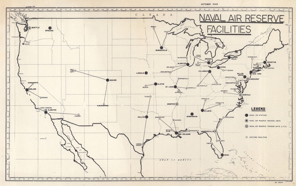
Naval Air Reserve Facilities.
1948 (dated) 9 x 14 in (22.86 x 35.56 cm) 1 : 15090240
1948 (dated) 9 x 14 in (22.86 x 35.56 cm) 1 : 15090240
Description
This is an October 1949 U.S. Navy Hydrographic Office map of the United States marking U.S. Naval Air Reserve bases across the United States. It sheds light on the U.S. Naval training following World War II (1939 - 1945).
A Closer Look
Naval Air Stations are marked with black dots, while smaller white circles identify 'outlying facilities'. Training units are identified at Jacksonville, Florida; Norfolk, Virginia; Memphis, Tennessee; and Seattle, Washington. The training facility at Lakehurst, New Jersey, focuses on the Navy's lighter-than-air program.Publication History and Census
This map was created by the U.S. Navy Hydrographic Office and published in October 1949. This is the only known cataloged example.Cartographer
United States Hydrographic Office (1866 - 1962) was a brach of he U.S. Navy that prepared and published maps, charts, and nautical books to aid in navigation. Before the establishment of the Hydrographic Office in 1866, U.S. navigators were almost entirely dependent on British charts. There had been a few private enterprises that had prepared and published charts, but none had been able to do so profitably. The Office was established 'for the improvement of the means of navigating safely the vessels of the Navy and of the mercantile marine, by providing, under the authority of the Secretary of the Navy, accurate and cheap nautical charts, sailing directions, navigators, and manuals of instructions for the use of all vessels of the United States, and for the benefit and use of navigators generally.' This way the Navy Department could furnish navy and merchant ships with charts illustrating the results of surveys and explorations undertaken by naval officers. The charts were priced to cover the cost of paper and printing alone, not preparation. Its main objective was to survey foreign coasts, as the Coast and Geodetic Surveys were responsible for surveying domestic waters. The Hydrographic Office was transferred from the Department of the Navy to the Department of Defense in 1949 and was replaced by the Naval Oceanographic Office in 1962. More by this mapmaker...
Condition
Very good.