1854 Black Map of New South Wales, Australia
NewSouthWales-black-1854$125.00

Title
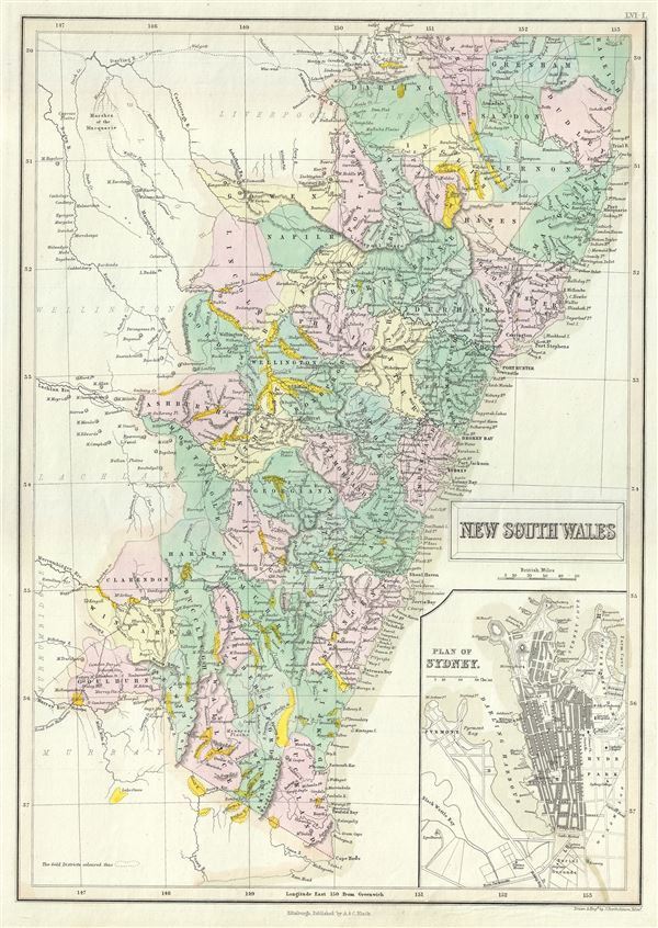
New South Wales.
1854 (undated) 15.5 x 11 in (39.37 x 27.94 cm) 1 : 2450000
1854 (undated) 15.5 x 11 in (39.37 x 27.94 cm) 1 : 2450000
Description
This is a fine example of the 1854 Black Map of New South Wales, Australia. It covers the settled areas of New South Wales from Raleigh to Auckland. The coastlines are accurately mapped, while the interior remains relatively unmapped. An inset in the lower right quadrant features the plan of Sydney. Important cities, towns, rivers, bays and other topographical features are noted, and elevation is rendered by hachures. The map also notes several gold districts throughout. The Australian gold rush, which started in the 1851, would attract a large number of international immigrants, tripling its population within the next 20 years. This map was engraved by J. Bartholomew and issued in as plate number LVI-I in the 1854 edition of Black's General Atlas Of The World.
Cartographer
Charles and Adam Black (fl. 1807 - present) were map and book publishers based in Edinburgh. Charles and his uncle, Adam, both of Edinburgh, Scotland, founded their publishing firm in 1807. They published a series of maps and atlases throughout the 19th century. In addition to an array of atlases, the Black firm is known for their editions of the Encyclopedia Britannica (1817 - 1826) and the first publishing of Sir Walter Scott's novels in 1854. In 1889 the A. & C. Black publishing house moved to London where it remains in operation to this day. More by this mapmaker...
Source
Black, A. and C., General Atlas Of The World, 1854
Condition
Very good. Blank on verso.
References
Rumsey 2305.067. Phillips (Atlases) 4334.