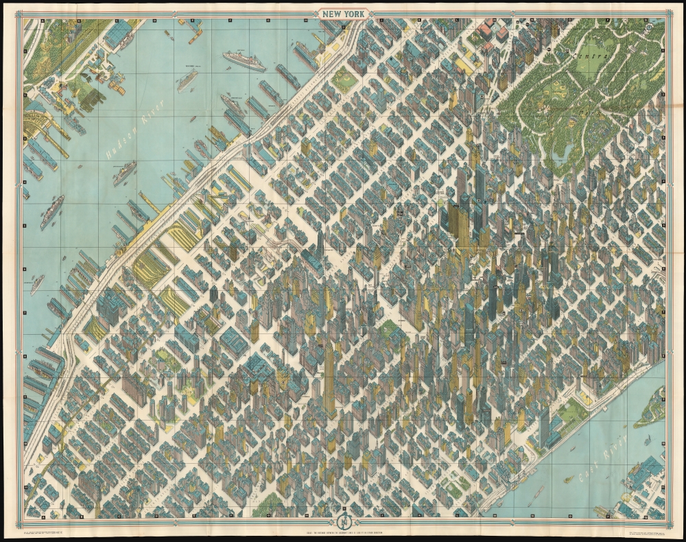
This is the 1962 Bollmann axonometric map of midtown Manhattan, in its 1964 issue. This distinctive view presents the area at the stylistic peak of the skyscraper era: over half of the world's skyscrapers standing at the time appear within the bounds of this view.
Making of the Map
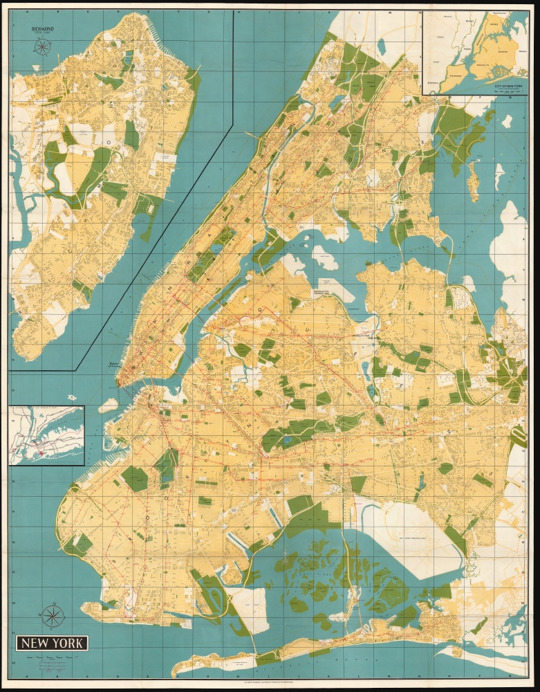
Bollmann created an image of great, apparent precision by employing subtle distortion and exaggeration to emphasize scale and clarity. The entire work was first drawn by hand, and its preparation boasted the use of over 67,000 photographs, 17,000 of which were aerial. Bollmann widened the streets to keep the image uncluttered; his view dispenses with perspective to maintain a uniform scale for all the buildings and allow comparison of size. The result captures this mighty concentration of towers, presenting each with its uniquely recognizable profile: the iconic Empire State building, the graceful Art Deco curves of the Chrysler building, the sleek blade of the United Nations, and the ultra-modern helicopter pad of the Pan Am building. The verso of the map is a detailed subway map of the five boroughs; the map dates itself by the presence of John F. Kennedy International Airport. Also, this edition included promotions for American Airlines, and marked the locations of several midtown American Airlines ticket offices (notably at the Pan Am building, and Columbus Circle. Another distinguishing factor between this and the two earlier editions was the inclusion of an additional ocean liner in the Hudson: Furness Lines' 'Queen of Bermuda,' fresh from its 1962 refitting and plying the route between New York and Bermuda.Publication History
Bollmann printed this first edition of this view in Germany in 1962. This is the second of two American editions, printed to promote the New York World's Fair In 1963 and 1964. In addition to the changed verso map, there are significant typographical differences between this and both earlier editions of the map. Both the 1963 and 1964 New York-printed editions employ a brighter palette than the German edition. A further printing of this view, printed on one side in a smaller format and lacking a guidebook, was issued in the 1980s. Examples of these, in various editions, are represented in institutional collections with varying degrees of precision in cataloging.
Cartographer
Herman Bollmann (1911 - 19??) was a German cartographer and map maker active from roughly 1940 to 1970. Prior to World War II, Bollmann was a well-known woodcarver and engraver based in Braunschweig, Germany. Following the war Bollmann developed a reputation as a printer of unique three dimensional maps. Working over a period of 25 years, Bollmann established a reputation as an artistic cartographer, producing over 39 unique projections of various cities in Europe and America. Bollmann revived the 19th century cartographic technique known as Vogelschaukarten, a way of making three dimensional axonometric projections. Bollmann and his team relied heavily on aerial cartography to compose distinctive cartographic masterpieces that are coveted by collectors all over the world. More by this mapmaker...
Very good. Comes with original guide and covers. Few mended junctures of folds.
Rumsey 8532.000. Augustyn, R. T., Cohen, P., Manhattan in Maps 1527 - 1995, 152 - 153.