This item has been sold, but you can get on the Waitlist to be notified if another example becomes available, or purchase a digital scan.
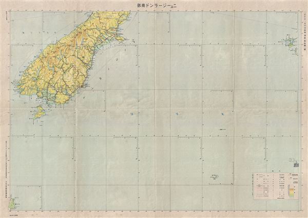
1942 or Showa 17 World War II era Japanese Aviation Map of Southern New Zealand
NewZealandSouth-showa17-1942$100.00

Title
New Zealand South Aviation Chart.
1942 (undated) 30 x 42 in (76.2 x 106.68 cm) 1 : 1500000
1942 (undated) 30 x 42 in (76.2 x 106.68 cm) 1 : 1500000
Description
This is a scarce 1942 or Showa 177 Japanese map of southern New Zealand issued by the Japan Army General Staff. It covers the southern portion of the South Island, the world's 12th largest island, including Stewart Island and Auckland Island. This World War II era map is highly detailed and notes important cities, towns, rivers, roads, shipping lines and other important topographical features. All text is in Japanese.
Condition
Very good. Minor wear and verso repair along original fold lines. Overall age toning.