1955 Farrell Pictorial Map of Newburyport, Massachusetts
Newburyport-farrell-1955$175.00
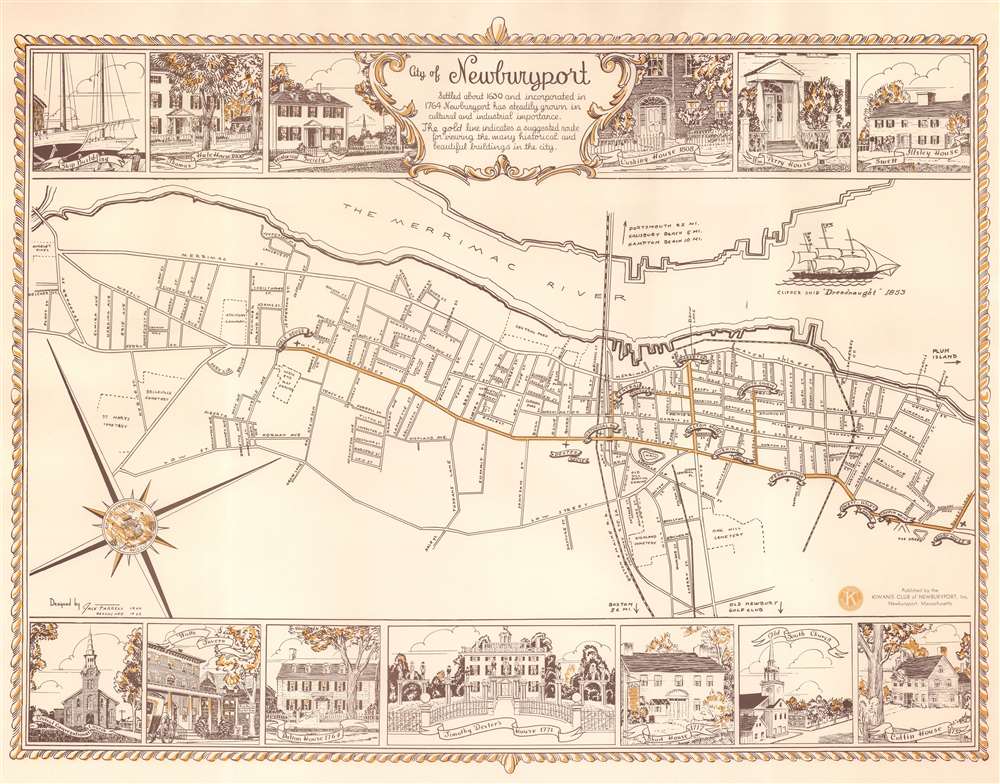

Title
City of Newburyport.
1955 (dated) 17.25 x 22 in (43.815 x 55.88 cm) 1 : 15000
1955 (dated) 17.25 x 22 in (43.815 x 55.88 cm) 1 : 15000
Description
This is a 1955 Jack Farrell pictorial map of Newburyport, Massachusetts, depicting from Spofford Street and Moseley Pines to Rolef's Lane. Streets are illustrated and labeled throughout. Banners mark Hale House, Central Church, Dexter House, and Old South Church, along with several other locations. Black and white dashed lines trace the Boston and Maine Railroad's route through town. Other dashed lines illustrate city cemeteries. A series of views create the top and bottom border and depict key locations around town, including the Thomas Hale House, the Historical Society, the Swett Illsley House, and the Old South Church.
Publication History and Census
This map was created by Jack Farrell and published in two editions. The first edition appeared in 1940 and a revised edition (of which the present example is representative) was published in 1955. We note two cataloged examples of the 1940 imprint, but the 1955 imprint is not cataloged in any institutional collections and we have seen no record of it appearing on the private market.Condition
Very good.