1945 Westring Map of Post World War II Occupation Zones in Germany
OccupationZones-westring-1945$425.00

Title
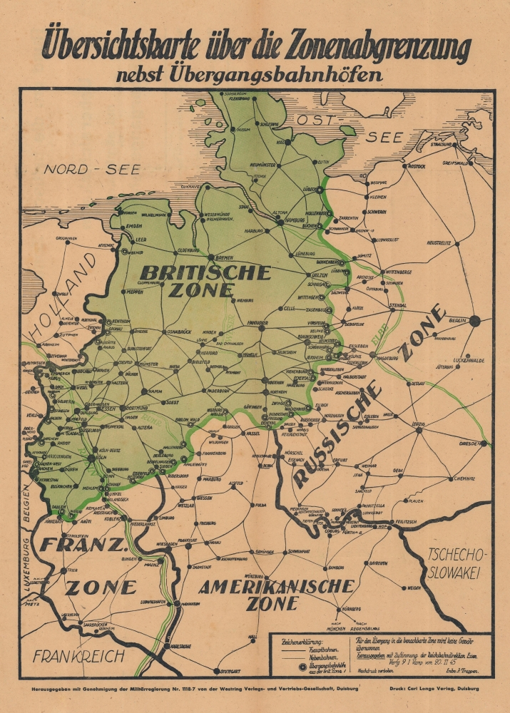
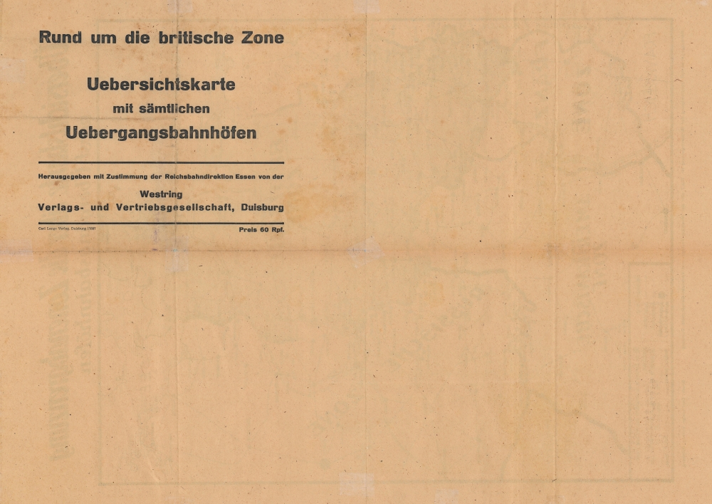
Übersichtskarte über die Zonenabgrenzung nebst Übergangsbahnhöfen. / Rund um die britische Zone Uebersichtskarte mit sämtlichen Uebergangsbahnhöfen.
1945 (dated) 22.25 x 16 in (56.515 x 40.64 cm)
1945 (dated) 22.25 x 16 in (56.515 x 40.64 cm)
Description
This is a Westring Verlags- und Vertriebs-Gesellschaft map of post-World War II occupation zones in Germany. It illustrates the transitional zones that evolved in the division of Germany into democratic West Germany and communist East Germany.
A Closer Look
Depicting from Süderlügum south to Stuttgart, Germany is divided into four Occupation Zones: British (colored green), French, American, and Russian. Cities and towns are labeled throughout with rail lines illustrated. Many cities along the borders of the British Zone are marked as 'transition zones'.The Allied Occupation of Germany
At the February 1945 Yalta Conference at the end of World War II (1939 - 1945), the United States, Great Britain, and the Soviet Union divided conquered Germany into zones of occupation. Nonetheless, the cordiality between the Western Allies and the Soviet Union began evaporating soon after, and by 1947, efforts to govern Germany jointly floundered. The British and American zones merged on January 1, 1947, creating the jointly administered 'Bizone'. This entity was soon joined by the French zone, thus 'Trizone'. The Trizone merged to form the Federal Republic of Germany (West Germany) in May 1949. In October 1949, the Soviets established the German Democratic Republic (East Germany). The occupation of West Germany continued until May 5, 1955, when the General Treaty, which transferred governance from the Allied military governments to civilian German leaders, went into effect.Publication History and Census
This map was published by Westring Verlags- und Vertriebs-Gesellschaft and printed by Carl Lange Verlag in November 1945. We note two cataloged examples in OCLC: Landesbibliothekszentrum Reinland-Pfalz and the Univeristät Regensburg. We have found records of a handful of examples entering the market in recent years.Condition
Good. Wear along original fold lines. Verso repairs to fold separations. Closed edge tears professionally repaired on verso. Old verso repairs to fold separations and at a fold intersection.
References
OCLC 1071617790, 634388145.