This item has been sold, but you can get on the Waitlist to be notified if another example becomes available, or purchase a digital scan.
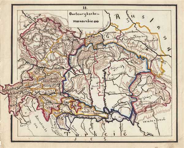
1871 Sikkel Manuscript Map of the Austrian Empire
Oostenryksche-sikkel-1871$100.00

Title
Oostenryksche-monarchie.
1871 (undated) 8 x 10 in (20.32 x 25.4 cm)
1871 (undated) 8 x 10 in (20.32 x 25.4 cm)
Description
This is a wonderful whimsical 1871 manuscript map of the Austrian Empire. Hand-drawn by J. C. Sikkel, the map covers the territories claimed by the once vast Austrian Empire, including in whole or part of the modern day nations of Austria, Hungary, Germany, Slovakia and the Czech Republic. The map shows beautifully rendered topography, with cities, towns, rivers, and provinces identified.
The Austrian empire, founded in 1804 by the last Holy Roman emperor, Francis II, lasted only till 1866. It was transformed into the Austro-Hungarian Empire after Austria was defeated in the Austro-Prussian War of 1866.
The Austrian empire, founded in 1804 by the last Holy Roman emperor, Francis II, lasted only till 1866. It was transformed into the Austro-Hungarian Empire after Austria was defeated in the Austro-Prussian War of 1866.
Condition
Very good. Minor spotting.