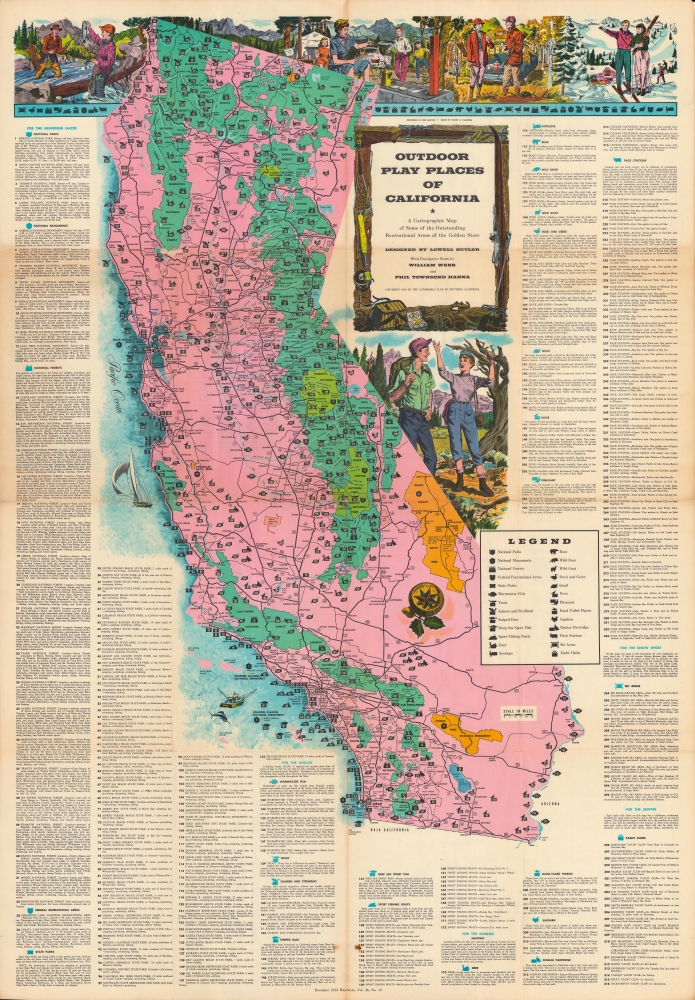
A distinctive work of mid-century Californiana and Americana, this large-format map was issued in 1954 by the Automobile Club of Southern California in its publication Westways. Displaying the entire Golden State, it locates federal and state park lands, along with designated areas for fishing, hunting, skiing, and boating.
A Closer Look
The state of California is depicted in brilliant color, with national parks, forests, monuments, and recreation areas colored light green, dark green, or orange, highlighting their large share of California's total land. These sites, in addition to state parks, recreation areas, and areas set aside for skiing, hunting, boating, and fishing, more than 300 sites in all, are also labelled with numbers corresponding to an index surrounding the map. A legend explains additional symbols employed. Cities and highways are also noted, clarifying the ease with which these sites could be reached from major metropolitan areas. Illustrations at top and below the title cartouche are sure to include women, and children, in the idealized outdoor activities, reflecting the values (and marketing strategy) of the Automobile Club.Publication History and Census
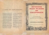
This map appeared with the December 1954 issue of Westways magazine, published by the Automobile Club of Southern California. It was designed by Lowell Butler, with descriptive notes by William Webb and Phil Townsend Hanna, drawings by Ken Sawyer, and coloring by Harry O. Diamond. As noted on the verso, the map took nearly a year to prepare, including extensive research on sites and their regulations. It is noted among the holdings of 19 institutions in the OCLC, and additionally is held by the Huntington Library and the David Rumsey Historical Map Collection.
CartographerS
The Automobile Club of Southern California (1900 - Present) is an auto club based in Los Angeles, California and an affiliate of the American Automobile Association (AAA). Founded in 1900, it was one of the first auto clubs in the United States and was dedicated to proposing traffic laws, improving road conditions, and the overall improvement of driving conditions. The Auto Club began producing its own maps in 1910, when it sent out its own team of cartographers to survey the state's roads. Its main office at the corner of Figueroa Street and Adams Boulevard was completed in 1923. Numbering nearly 8 million members in its home territory alone, today it is the largest single member of the AAA federation More by this mapmaker...
Lowell Butler (fl. c. 1937 - 1971) was an illustrator who served as Art Director for Westways magazine, published by the Automobile Club of Southern California. He produced some of the organization's most iconic maps, including 'A Map of the Marked Historical Sites of California' (1952), 'Outdoor Play Places of California' (1954), and 'Spanish California: A Map of the Missions, Presidios, Pueblos and Some of the More Interesting Ranchos' (1956). Learn More...
Source
Automobile Club of Southern California, Westways, Vol. 46, No. 12, Dec. 1954.
Good. Wear and toning along fold lines, with reinforcements and repairs on verso.
Rumsey 6835.002. OCLC 876789359.