
Automobile Club of Southern California
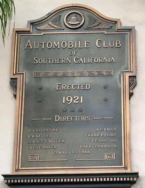
The Automobile Club of Southern California (1900 - Present) is an auto club based in Los Angeles, California and an affiliate of the American Automobile Association (AAA). Founded in 1900, it was one of the first auto clubs in the United States and was dedicated to proposing traffic laws, improving road conditions, and the overall improvement of driving conditions. The Auto Club began producing its own maps in 1910, when it sent out its own team of cartographers to survey the state's roads. Its main office at the corner of Figueroa Street and Adams Boulevard was completed in 1923. Numbering nearly 8 million members in its home territory alone, today it is the largest single member of the AAA federation
Drive safely!
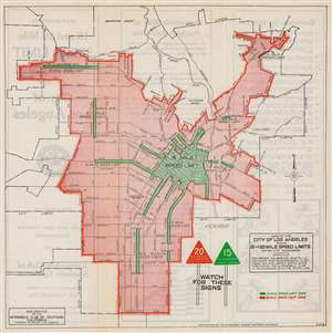
Map of the City of Los Angeles Showing 15 and 20 Mile Speed Limits Within City Boundaries.
$200.00
Acquire
- Digital Map Information
- Suitable for large format printing
- Full resolution TIFF file
- ICC color profile embedded
- Delivered instantly via download link
This is a c. 1923 Automobile Club of Southern California map of Los Angeles speed limits. Areas of green and orange shading highlight parts of Los Angeles where the speed limit is fifteen (green) or twenty (orange) miles per hour. More detail appears in the fifteen mile per hour zones than in the twenty mile per hour zones, with cross streets marked in each of the fifteen mile per hour zones, some of which are relatively small. Major streets within Los Angeles are illustrated and labeled, but very little else appears. The only building labeled is the Automobile Club of Southern California building. (more details)
The best fishing.
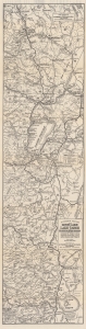
Automobile Road Map from Mono Lake to Lake Tahoe and Feather River Region Showing Resorts, Camp Sites, Fishing Streams, Lakes, Mtn. Peaks, and Trails.
$1,000.00
Acquire
- Digital Map Information
- Suitable for large format printing
- Full resolution TIFF file
- ICC color profile embedded
- Delivered instantly via download link
This is a 1930 Automobile Club of Southern California fishing and road map of Lake Tahoe and the Feather River, California. Coverage extends from Spring Garden south to Lake Mono and Yosemite Valley. The map is unique in its details presentation of premium angling sites in the Feather River Valley and High Sierra. (more details)
Californian Commemoration of the Spanish Empire.
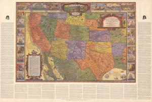
A Map of Exploration in the Spanish Southwest 1528-1793.
$275.00
Acquire
- Digital Map Information
- Suitable for large format printing
- DPI: 600
- File Size: 114.66 MB
- File Type: ZIP / TIFF
- ICC color profile embedded
- Delivered instantly via download link
This is a large-format 1932 pictorial map of the American Southwest, produced by the Automobile Club of Southern California. It is characteristic of the early 20th-century romanticization of the Spanish colonial era, which played an important part in the development of a distinctly Southern Californian identity. The map emerged during the Golden Age of American Pictorial Mapmaking. (more details)
Bears manuscript notations following possible road trips.
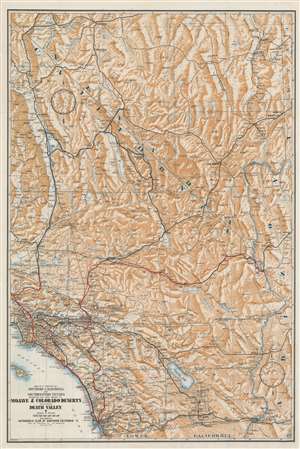
Map of a Portion of Southern California and Southwestern Nevada Embracing the Arid Region of Mojave and Colorado Deserts Including Death Valley.
$300.00
Acquire
- Digital Map Information
- Suitable for large format printing
- Full resolution TIFF file
- ICC color profile embedded
- Delivered instantly via download link
This is a c. 1933 Automobile Club of Southern California map of southern California and southwestern Nevada. Depicting the region from Tonopah, Nevada to Baja California and from the Sequoia National Park to Arizona and Utah, the region's major highways snake their way across the barren landscape. Cities and towns are labeled throughout, along with rivers and lakes. Its many mountain ranges are illustrated artistically and identified, but elevations are not indicated. Red and blue manuscript notations, which appear to be drawn in crayon, trace what are presumably road trip itineraries, but that is unclear. Perhaps this particular map was used to keep a child entertained while their parents explored the area during two separate trips. (more details)
Santa Monica and Beverly Hills!
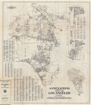
Annexations of the City of Los Angeles.
$450.00
Acquire
- Digital Map Information
- Suitable for large format printing
- Full resolution TIFF file
- ICC color profile embedded
- Delivered instantly via download link
This is a c. 1933 Automobile Club of Southern California city plan or map of Santa Monica and Beverly Hills, California. Depicting from the Santa Susanna Mountains and the Simi Hills to the Los Angeles and from the San Gabriel Mountains to El Segundo and Inglewood, suburbs throughout identified, including North Hollywood and Van Nuys. Major streets are illustrated and labeled, along with the Southern Pacific Railroads. An alphabetic street index occupies the lower left, along with an extensive addenda. An inset along the right illustrates Los Angeles from Manchester Street south to San Pedro and Los Angeles Harbor. A second inset in the lower left maps the entire region from the Fernando Reservoir to San Pedro. (more details)
From Mining Hotspot to Tourist Haven.
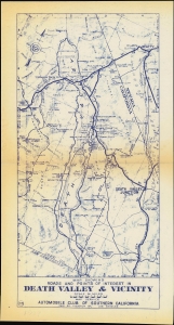
Map Showing Roads and Points of Interest in Death Valley and Vicinity.
$150.00
Acquire
- Digital Map Information
- Suitable for large format printing
- Full resolution TIFF file
- ICC color profile embedded
- Delivered instantly via download link
A scarce separately issued map of Death Valley and surroundings near the border of California and Nevada, produced c. 1930 by the Automobile Club of Southern California. It captures the region at a moment of transition from an isolated base for scattered mining operations to a tourist attraction known for its hot springs and stunning natural beauty. (more details)
Paradise on Earth - just a car ride away.
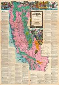
Outdoor play places of California : a cartographic map of some of the outstanding recreational areas of the Golden State.
$225.00
Acquire
A distinctive work of mid-century Californiana and Americana, this large-format map was issued in 1954 by the Automobile Club of Southern California in its publication Westways. Displaying the entire Golden State, it locates federal and state park lands, along with designated areas for fishing, hunting, skiing, and boating. (more details)
Driving in L.A. - good luck with the traffic!
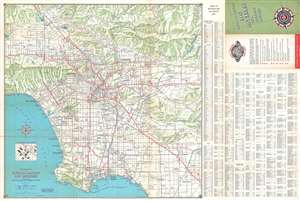
Metropolitan Los Angeles and Freeway System. / Automobile Road Map of Metropolitan Los Angeles. / Freeway System Los Angeles and Vicinity.
$200.00
Acquire
This is a 1970 Automobile Club of Southern California map of Los Angeles and vicinity, depicting from the Santa Susana and San Gabriel mountains south to Long Beach and Santa Ana. Los Angeles appears near center. Hollywood, Beverly Hills, Pasadena, Glendale, Burbank, Van Nuys, Manhattan Beach, Redondo Beach, and Anaheim rank among the identified cities. Red printed 'stamps' mark Automobile Club of Southern California offices, while red stippling and bold red lettering identify parks. Highways and freeways are illustrated in red, while other roads are in black. An index occupies the right side of the sheet and lists Automobile Club of Southern California offices; cities and towns; streets; mountains, peaks, canyons, and points; and points of interest among numerous other locations. A map of the freeway system of Los Angeles and vicinity is printed on the verso. An inset of downtown Los Angeles and its freeway system is situated along the top border on the verso. (more details)