1900 War Dept. Map of Panay, Philippines, during the Philippine-American War
Panay-chiefengineers-1900-2$750.00

Title
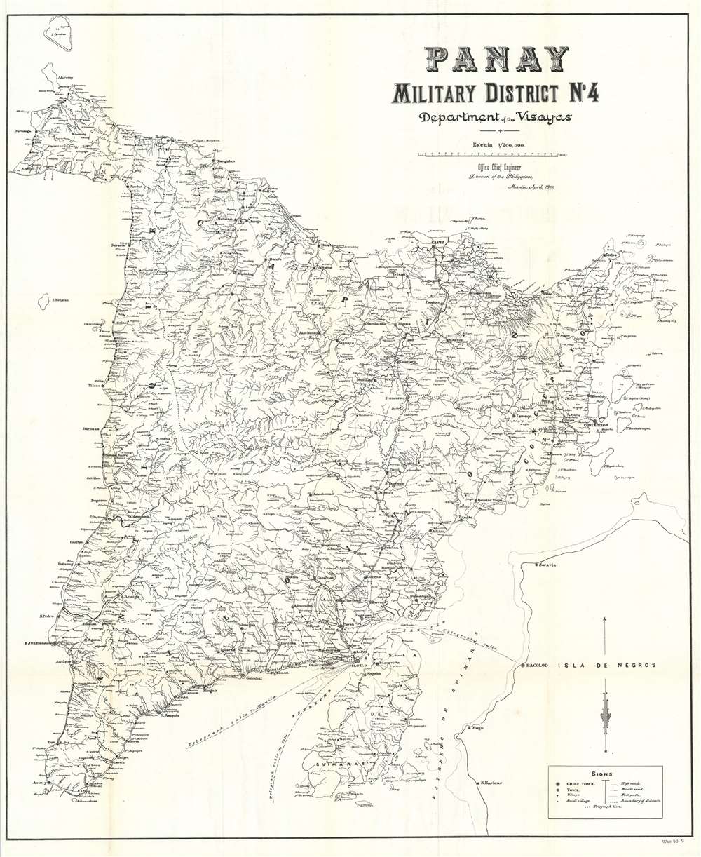
Panay. Military District No. 4. Department of the Visayas.
1900 (dated) 39.5 x 33 in (100.33 x 83.82 cm) 1 : 200000
1900 (dated) 39.5 x 33 in (100.33 x 83.82 cm) 1 : 200000
Description
This is a rare 1900 map of Panay, the Visayas, the Philippines, issued at the height of the Philippine-American War (1899 – 1902) by the Office of the Chief Engineer in the Philippines. The campaign in the Visayas began four days after the beginning of the campaign around Manila on Luzon. Fighting began at Iloilo (Ilo-Ilo) on Panay, followed closely by the occupation of Cebu City on Cebu and Bacolod on Negros. Highly detailed, the map depicts the entire island of Panay, including the myriad rivers, towns, and villages. The map also labels Negros, although the only town marked is Bacolod. Telegraph lines crisscross the island and also connect Iloilo to Manila, Cebu, and Bacolod.
The Philippine-American War
The Philippine-American War lasted from February 4, 1899, until July 2, 1902, when the Philippine Organic Act established the Second Philippine Commission and Philippine legislature. The war immediately followed the Spanish-American War, once the Filipinos realized that the Americans were in the islands to stay. Estimates of Filipino civilian casualties vary wildly, from at least 200,000 to over one million, the majority of which were caused by famine and disease. Armed resistance to the U.S. occupation of the Philippines continued as a guerrilla insurrection in many parts of the archipelago until June 1913. The U.S. passed the Tydings-McDuffie Act, also known as the Philippine Independence Act, in 1934. This law created the Commonwealth of the Philippines, increased self-governance, and scheduled Philippine independence for 1944. World War II delayed this process, and the U.S. did not grant full independence to the Philippines until 1946.Publication History and Census
This map was produced by the Office of the Chief Engineer, Division of the Philippines, in Manila in April 1900 and published in the Report of Maj. Gen. E. S. Otis, United States Army, Commanding Division of the Philippines, Military Governor in 1900. Three examples are cataloged in OCLC and are part of the institutional collections at Michigan State University, the University of Chicago, and the University of California Davis.Source
Otis, S.E., Report of Maj. Gen. E. S. Otis, United States Army, Commanding Division of the Philippines, Military Governor. (Washington: Government Printing Office) 1900.
Condition
Very good. Light wear and toning along original fold lines. Close left margin. Blank on verso.
References
OCLC 380833237.