This item has been sold, but you can get on the Waitlist to be notified if another example becomes available, or purchase a digital scan.
1889 Gigon Map of the Paris Exposition (Eiffel Tower)
ParisExposition-gigon-1889$150.00

Title
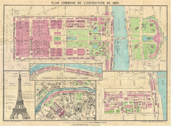
Plan Commode de L'Exposition de 1889.
1889 (dated) 15 x 20.5 in (38.1 x 52.07 cm) 2.472222222
1889 (dated) 15 x 20.5 in (38.1 x 52.07 cm) 2.472222222
Description
An uncommon map of Paris issued for the 1889 Paris World's Fair, or Exposition Universelle. Essentially four maps on a single sheet including a general map of the Champs de Mars, where the exposition was held, the Quai d'Orsay on the Left Bank of the Seine (south bank), where the Agriculture exposition was staged, a detail of the colonial exposition on the Esplanade des Invalides, and a general overview of this part of Paris. The chart also includes a profile of the Eiffel Tower, which was built for this fair.
The 1889 Paris World's Fair, or Exposition Universelle as it is known in French, was inarguably one of the most successful of the great expositions of the 19th century. The fair, held between May 6 and October 31, 1889, was intended to honor the 100th anniversary of the storming of the Bastille and consequently the start of the French Revolution. This Exposition was the fourth to be held in Paris and is most remembered today for the creation of the Eiffel Tower - the world's first modern skyscraper.
Engraved by L.C. Gigon of 1 Rue Thenard and published by L. Joly of 19 Quai St. Michel, both of Paris.
Condition
Very good. Attached to original cardboard binder. Minor wear on original fold lines.

