1936 Science Press City Map or Plan of Beijing / Peiping, China
Peiping-sciencepress-1936$600.00

Title
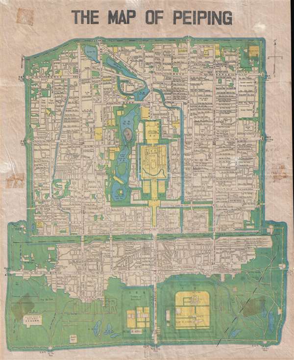
The Map of Peiping.
1936 (undated) 18 x 14.5 in (45.72 x 36.83 cm) 1 : 22400
1936 (undated) 18 x 14.5 in (45.72 x 36.83 cm) 1 : 22400
Description
This is a c. 1936 Science Press city map or plan of Beijing / Peiping, China. The map depicts the Outer city, the Inner city, the Imperial city, and the Forbidden City in minute detail. Myriad streets are labeled, along with various buildings, parks, temples, and altars. Several of the foreign legations are also labeled. Each of the locations is labeled in English, Chinese, and Romanized Chinese. Each of the different sections of the city are walled, with each of the gates depicted, all of which are labeled.
This map was created by Science Press and distributed by Lynn's Book Store, located at 128 Morrison Street in Beijing / Peiping. This map was issued along with a map depicting Bejing and its environs.
This map was created by Science Press and distributed by Lynn's Book Store, located at 128 Morrison Street in Beijing / Peiping. This map was issued along with a map depicting Bejing and its environs.
Condition
Very good. Even overall toning. Verso repairs to fold separations. Blank on verso.
References
LOC G7824.B4 1928. OCLC 5482197.