This item has been sold, but you can get on the Waitlist to be notified if another example becomes available, or purchase a digital scan.
1962 Touring Club Italiano Map or Plan of Rome, Italy
PiantaRoma-touringclub-1962$75.00

Title
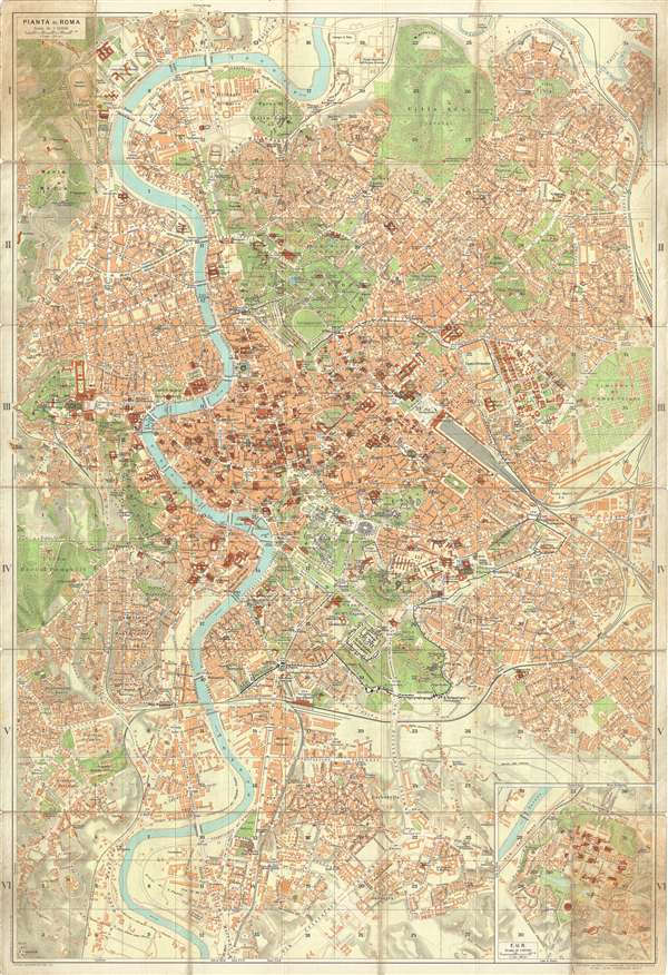
Pianta di Roma.
1962 (dated) 35 x 24 in (88.9 x 60.96 cm) 1 : 12000
1962 (dated) 35 x 24 in (88.9 x 60.96 cm) 1 : 12000
Description
This is a 1962 Touring Club Italiano tourist map of Rome, Italy. The map is oriented to the north and depicts from the Villa Ada to the Via Cristoforo Colombo and from the Vatican on the left to the Cimitero di Campo Verano on the right. The map centers on the ancient city center, and depicts the Colosseum, the Forum, the Circus Maximus, the Caracalla Baths and several other ancient sites in detail. The rest of the city is highly detailed as well, with all the major city streets labeled, as well as the Termini train station, the Cilla Borghese, and several piazzas. St. Peter's Basilica and St. Peter's Square are depicted in Vatican City. The parks and gardens in the city stand out, since their green coloring paints a sharp contrast against the buildings.
There is an inset map at the lower right corner depicting the E.U.R., or Esposizione Universale Roma. This was originally meant to be the site of the 1942 world's fair, which Benito Mussolini wanted to host to celebrate twenty years of fascism, but it never took place due to World War II. Now, it is a residential and business district in Rome.
This map was published in 1962 by the Touring Club Italiano, Milan.
Condition
Very good. Wear along original fold lines. Repaired tears on verso. Index on verso. Upper left panel, were originally attached to binder, exhibits wear and soiling.