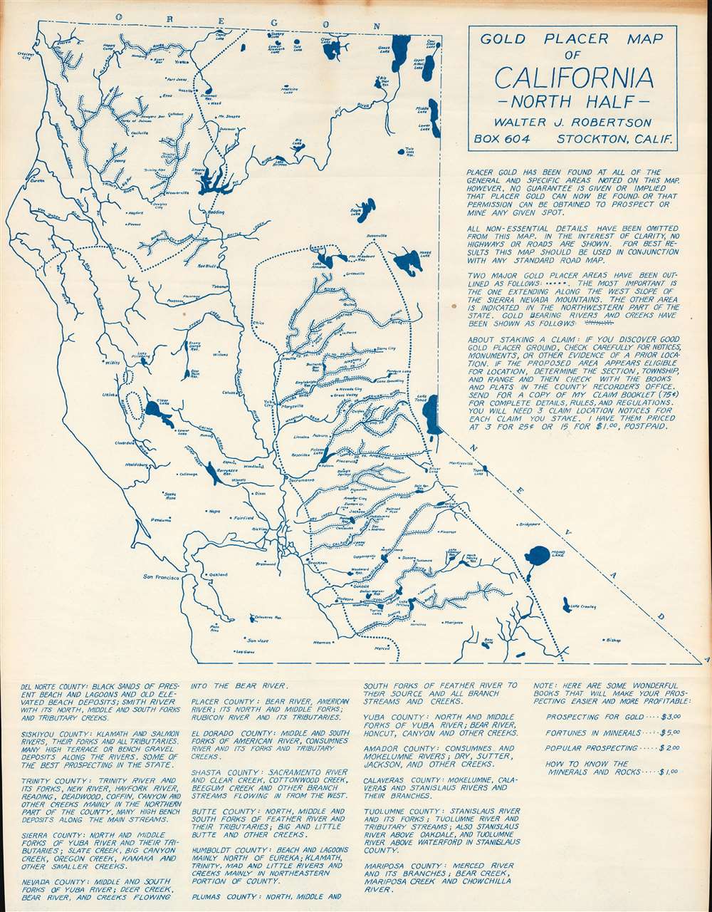
This is a c. 1956 Walter J. Robertson diazotype map of northern California placer gold deposits. Dotted lines outline regions where placer gold had been discovered: one in northwestern California and another along the western slopes of the Sierra Nevada Mountains. Dots line the banks of numerous rivers, illustrating where individuals hunting for gold might have some luck. Apart from these important rivers, very little else is illustrated here. Robertson states that this was a choice he made 'in the interest of clarity'.
The Latest in a Long Tradition
The gold rushes of the 19th century fostered the fantasy of 'striking it rich'. Even today, hobbyists pan for gold in California, the Yukon, and Colorado, among other sites. Robertson's map is part of this cultural niche.Diazo Print or Whiteprint
The diazo print (whiteprint or diazo for short) is a photo reproductive technique best understood as a reverse cyanotype or blueprint. The process yields distinctive blue lines on white paper. Like cyanotypes, the diazo process gained popularity in architecture circles, where it was a simple and effective way to duplicate documents in the field. The earliest diazotypes appeared around 1880 and were adopted for military and field cartographic use from about 1895. The diazo process was commercialized in 1923, when the German firm, Kalle and Company, developed Ozalid, a patented diazo paper that made diazotyping even easier. By the 1950s, it supplemented cyanotypes as the reprographic technique of choice for technical drawings.Publication History and Census
This map was created and published by Walter J. Robertson c. 1956. This is the only known cataloged example.
Cartographer
Walter James Robertson (October 2, 1910 - May 9, 1978) was an American publisher and cartographer. Born in Colorado, Robertson lived most of this life in Stockton, California. Beginning in the 1950s (or possibly earlier), Robertson began publishing materials dealing with mining, including a pamphlet titled 'Gold Panning for Profit'. He also published a series of placer mining maps of several western states, including Oregon, Arizona, and Northern and Southern California. More by this mapmaker...
Very good.