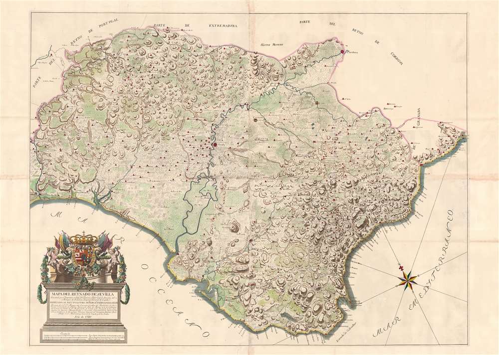
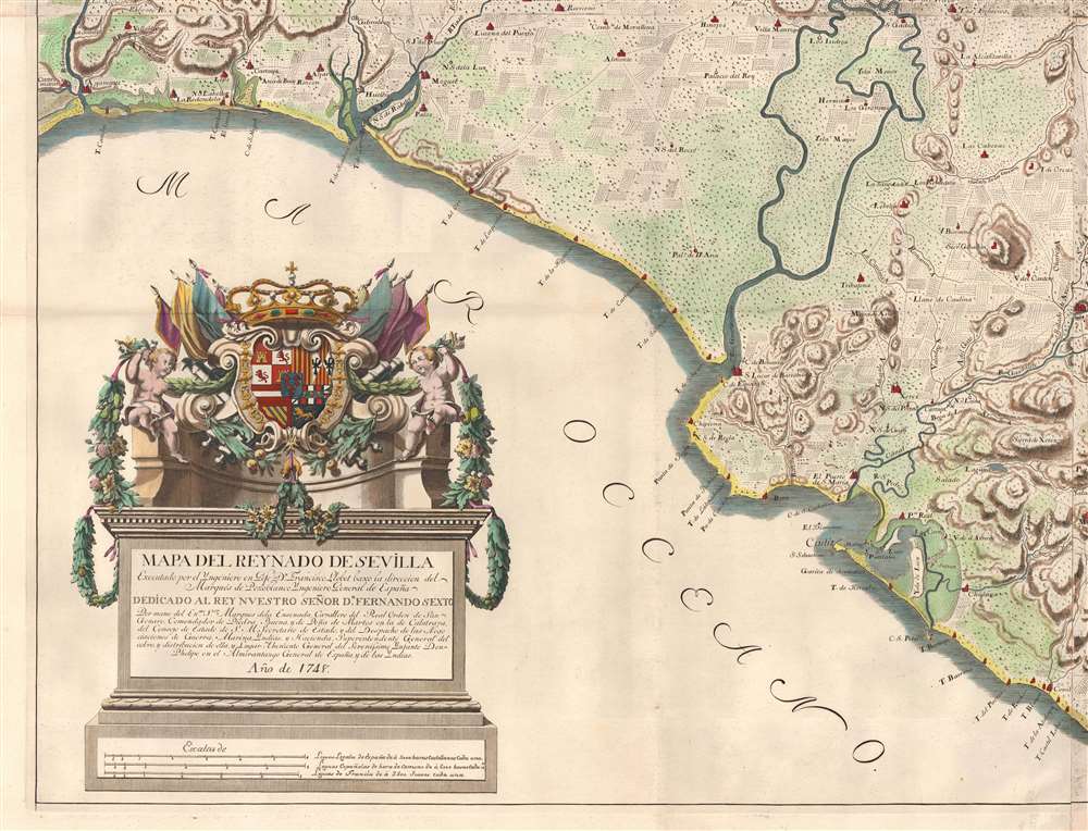
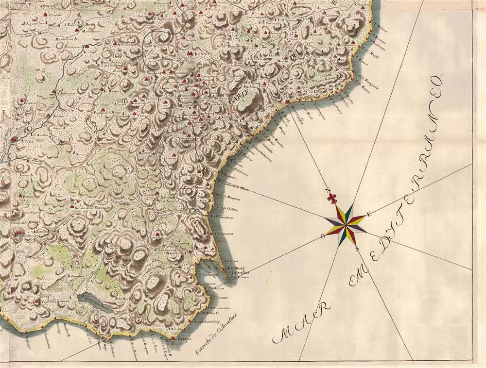
1748 Llobet Wall Map of the Kingdom of Seville / Sevilla, Spain
ReynadoSevilla-llobet-1748$2,500.00

Title
Mapa del Reynado de Sevilla executado por el Ingenioro en Geje Dn. Francisco Llobet.
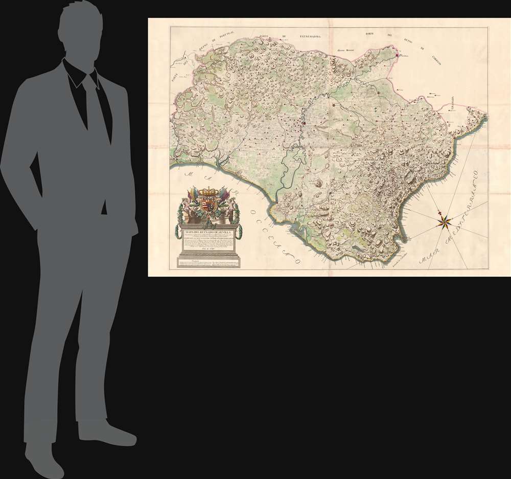
1748 (dated) 43 x 60 in (109.22 x 152.4 cm) 1 : 195000
1748 (dated) 43 x 60 in (109.22 x 152.4 cm) 1 : 195000
Description
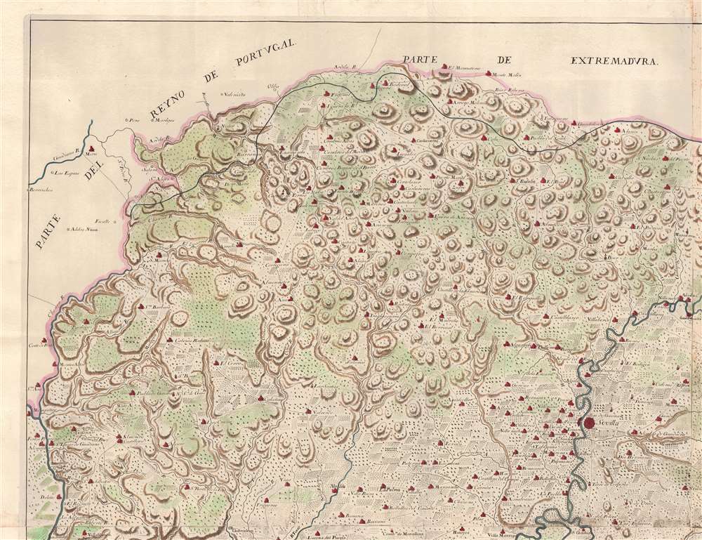
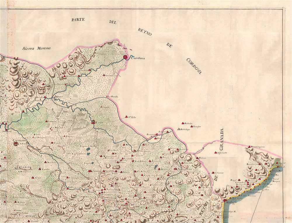
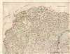
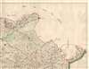
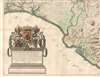
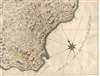
An exceptional 1748 wall map of the Kingdom of Sevilla or Seville, Spain, by Francisco Llobet. Coverage extends from the Guadiana River, or Odiana, which forms the western border of Sevilla and Portugal, to the border with Granada, and from Extremadura and Cordova to the Gulf of Cádiz. It is large, with meticulous detail, illustrating towns, villages, and roads. Some effort is made to further illustrate terrain, distinguishing between developed agricultural lands, mountains, marshy terrain, lowland plains, and forests. A dramatic cartouche in the lower left takes the form of a Romanesque plinth, surmounted by the royal arms of King Ferdinand VI (1713 - 1759).
Zenón de Somodevilla
While dedicated to King Ferdinand VI (1713 - 1759) of Spain, the map was commanded por mano by the Marques de la Ensenada, Zenón de Somodevilla (1702 - 1781). Holding four major positions in the Royal Court, Somodevilla was arguably the most influential individual in Spain short of the king himself. Uncommon for the time, is likely that Somodevilla rose to power from relatively humble circumstance through his superlative military and administrative capabilities. His administration (1748 - 1754) began in the year this map was published and was marked by extensive internal reforms intended to both foster economic development and shore up the power of the crown. Among his most important projects was the Catastro of Ensenada, a broad but exacting census of Spain compiling population, territorial properties, buildings, cattle, offices, all kinds of revenue and trades, and even geographical information in an effort to reform the state tax system. While this map predates the formal inception of the Catastro, its meticulous detail is a precursor of the more extensive survey and statical work that followed in 1749.Publication History and Census
The map is attributed to Francisco Llobet and was ordered by the Marqués de Pozoblanco, not an individual, but rather a royally appointed title created in 1687 by King Carlos II for Francisco Manuel de Velasco y Estrada (1681 - 1746). Velasco y Estrada was the Ingeniero General de España and was born in Sevilla, suggesting a possible deeper connection to the map. The imprint may refer to this individual, or it may refer to his son, Juan Manuel de Velasco Pimienta, the second Marqués de Pozoblanco.Condition
Very good. Some wear on old fold lines and glue discolorations where panels were joined by publisher. Minor loss - stabilized - at some fold intersections.
References
OCLC 495095994. Bibliothèque nationale de France, département Cartes et plans, GE DD-2987 (1707 B). National Library of Spain, MV / 110.