Digital Image: 1940 J. Roze Map of Riga, Latvia - the last plan of pre-Soviet Riga
Riga-roze-1940_d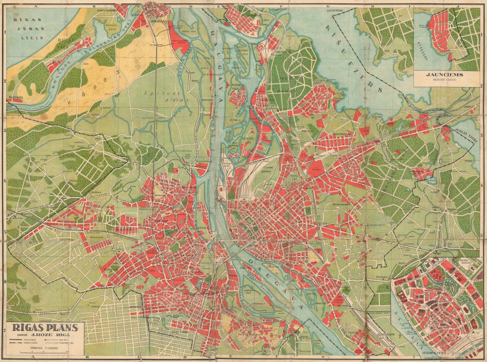
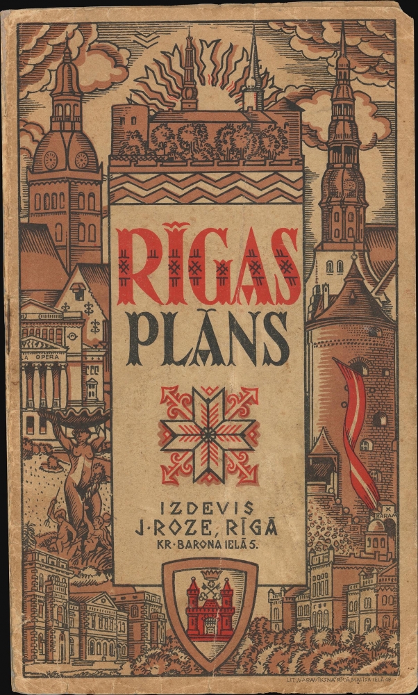


Title
Rīgas Plāns.
1940 (undated) 25.75 x 34.75 in (65.405 x 88.265 cm) 1 : 23000
1940 (undated) 25.75 x 34.75 in (65.405 x 88.265 cm) 1 : 23000
Description
FOR THE ORIGINAL ANTIQUE MAP, WITH HISTORICAL ANALYSIS, CLICK HERE.
Digital Map Information
Geographicus maintains an archive of high-resolution rare map scans. We scan our maps at 300 DPI or higher, with newer images being 600 DPI, (either TIFF or JPEG, depending on when the scan was done) which is most cases in suitable for enlargement and printing.
Delivery
Once you purchase our digital scan service, you will receive a download link via email - usually within seconds. Digital orders are delivered as ZIP files, an industry standard file compression protocol that any computer should be able to unpack. Some of our files are very large, and can take some time to download. Most files are saved into your computer's 'Downloads' folder. All delivery is electronic. No physical product is shipped.
Credit and Scope of Use
You can use your digial image any way you want! Our digital images are unrestricted by copyright and can be used, modified, and published freely. The textual description that accompanies the original antique map is not included in the sale of digital images and remains protected by copyright. That said, we put significant care and effort into scanning and editing these maps, and we’d appreciate a credit when possible. Should you wish to credit us, please use the following credit line:
Courtesy of Geographicus Rare Antique Maps (https://www.geographicus.com).
How Large Can I Print?
In general, at 300 DPI, you should at least be able to double the size of the actual image, more so with our 600 DPI images. So, if the original was 10 x 12 inches, you can print at 20 x 24 inches, without quality loss. If your display requirements can accommodate some loss in image quality, you can make it even larger. That being said, no quality of scan will allow you to blow up at 10 x 12 inch map to wall size without significant quality loss. For more information, it is best consult a printer or reprographics specialist.
Refunds
If the high resolution image you ordered is unavailable, we will fully refund your purchase. Otherwise, digital images scans are a service, not a tangible product, and cannot be returned or refunded once the download link is used.
Cartographer S
Jānis Roze (1878 - May 1942) was a Latvian bookseller and publisher active in Riga during the early to mid-20th century. Roze founded his business, which operated as J. Roze during World War I (1914 - 1918), when rent in Riga reached an all-time low, allowing him to economically lease a large space in a premium location at K. Barona Street 3. In 1923, shortly after the war, he also acquired the stock and premises of the long-established but by that time defunct bookseller D. Golt. He published his first book in 1918, a self-compiled dictionary of foreign words. The firm prospered, publishing nearly 750 different books, as well as maps and other documents. When the Soviets occupied Latvia in 1940, the firm was nationalized, and Roze was sent to Siberia, where he died of starvation in 1942. Today, a new bookseller has emerged named in honor of J. Roze. More by this mapmaker...
Litogrāfija Varavīksna (fl. c. 1930 - 1940) was a lithographic printing house active in Riga during the early 20th century. As the name suggests (Varavīksna translates to 'Rainbow'), the firm specialized in color printing and chromolithography. Like most Latvian businesses, Varavīksna was nationalized during the Soviet occupation in the 1940s. Learn More...
References
OCLC 255055545.