1968 Esso City Plan or Map of Saigon, Vietnam during the Vietnam War
Saigon-esso-1968$650.00

Title
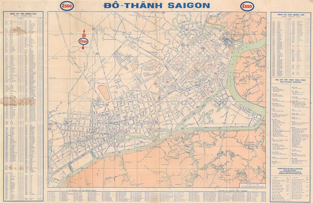
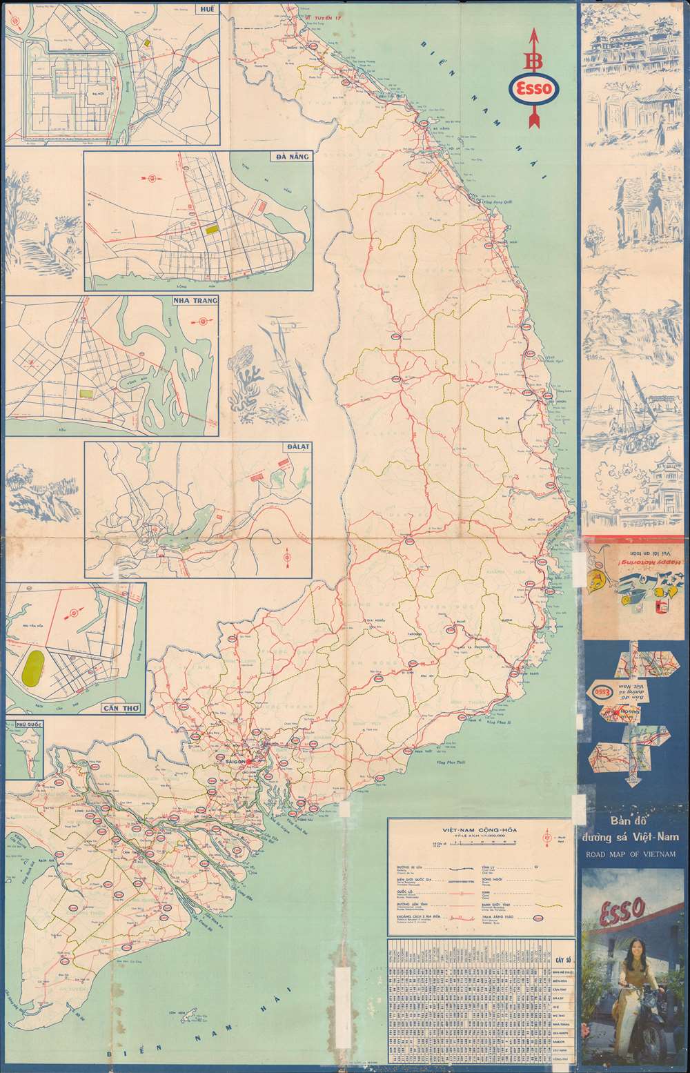
Đô - Thành Saigon. / Citadel of Saigon. / Bản đồ đường sá Việt Nam. / Road Map of Vietnam.
1968 (dated) 24.5 x 37.5 in (62.23 x 95.25 cm) 1 : 10000
1968 (dated) 24.5 x 37.5 in (62.23 x 95.25 cm) 1 : 10000
Description
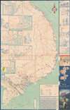
This is a 1968 Vietnam War Era Esso city plan or map of Saigon, Vietnam. The map was issued to promote Esso gas with Esso symbols marking stations throughout. Streets are labeled in Vietnamese and an alphabetic street index appears outside the left and right borders. 147 locations are numerically identified and correspond with an index below the bottom border. A road map of South Vietnam occupies the verso. Tere are inset maps of Huế, Đã Nẵng, Nha Trang, Đàlạt, Cấn Thơ, and Phú Quốc.
The Vietnam War
The Vietnam War, known in Vietnam as the Resistance War Against America or simply the American War, raged between November 1, 1955, and April 30, 1975, when Saigon fell to the North Vietnamese. A complicated conflict with an even more complicated history and legacy, the Vietnam War pitted the North Vietnamese, led by Ho Chi Minh, against the South Vietnamese. The South Vietnamese were supported by the United States, while the Soviet Union and China supported the North Vietnamese. American anti-communist dogma and fear that 'if one country fell to Communism, then more would fall' drove participation in the far-off civil war. As the conflict grew, American involvement became increasingly overt. Finally, in 1964, American ground troops were sent into combat. In 1968, U.S. troop strength in Vietnam reached its maximum at 549,500 soldiers. The same year saw the Tet Offensive, the most successful North Vietnamese campaign against American forces, and a waning of American home front support. U.S. forces withdrew in January 1973, and Saigon fell to the North Vietnamese on April 30, 1975.Publication History and Census
This map was created for and published by the Esso Company in 1968. We note five examples cataloged in OCLC which are part of the collections at Harvard University, Pennsylvania State University, the University of Miami, the University of Kansas, and the University of Hawaii at Manoa.Condition
Good. Exhibits wear, toning, and light soiling along original fold lines. Light dampstainging. Areas of infill along original fold lines. Road map of South Vietnam on verso.
References
OCLC 52891534.