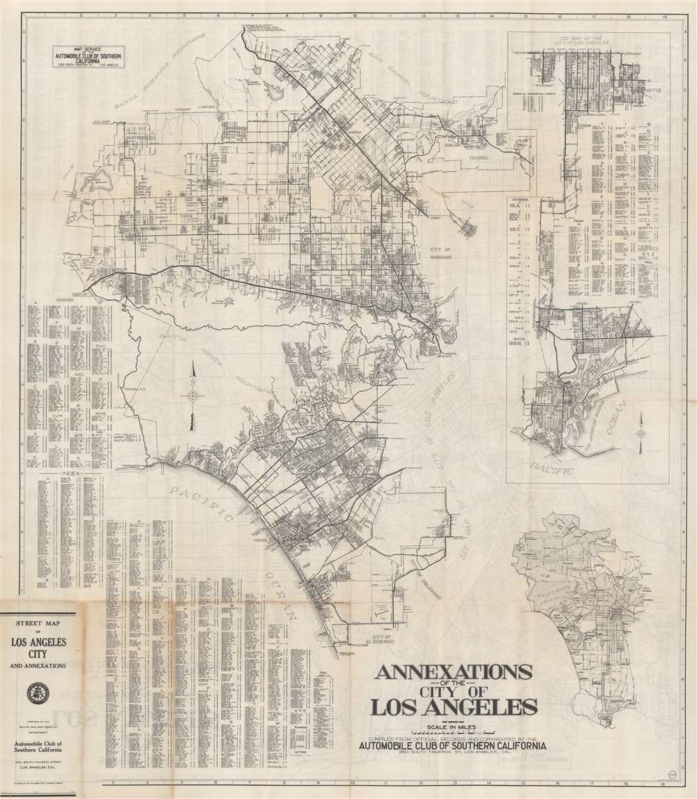
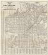
This is a c. 1933 Automobile Club of Southern California city plan or map of Santa Monica and Beverly Hills, California. Depicting from the Santa Susanna Mountains and the Simi Hills to the Los Angeles and from the San Gabriel Mountains to El Segundo and Inglewood, suburbs throughout identified, including North Hollywood and Van Nuys. Major streets are illustrated and labeled, along with the Southern Pacific Railroads. An alphabetic street index occupies the lower left, along with an extensive addenda. An inset along the right illustrates Los Angeles from Manchester Street south to San Pedro and Los Angeles Harbor. A second inset in the lower left maps the entire region from the Fernando Reservoir to San Pedro.
The Map of Los Angeles on Verso
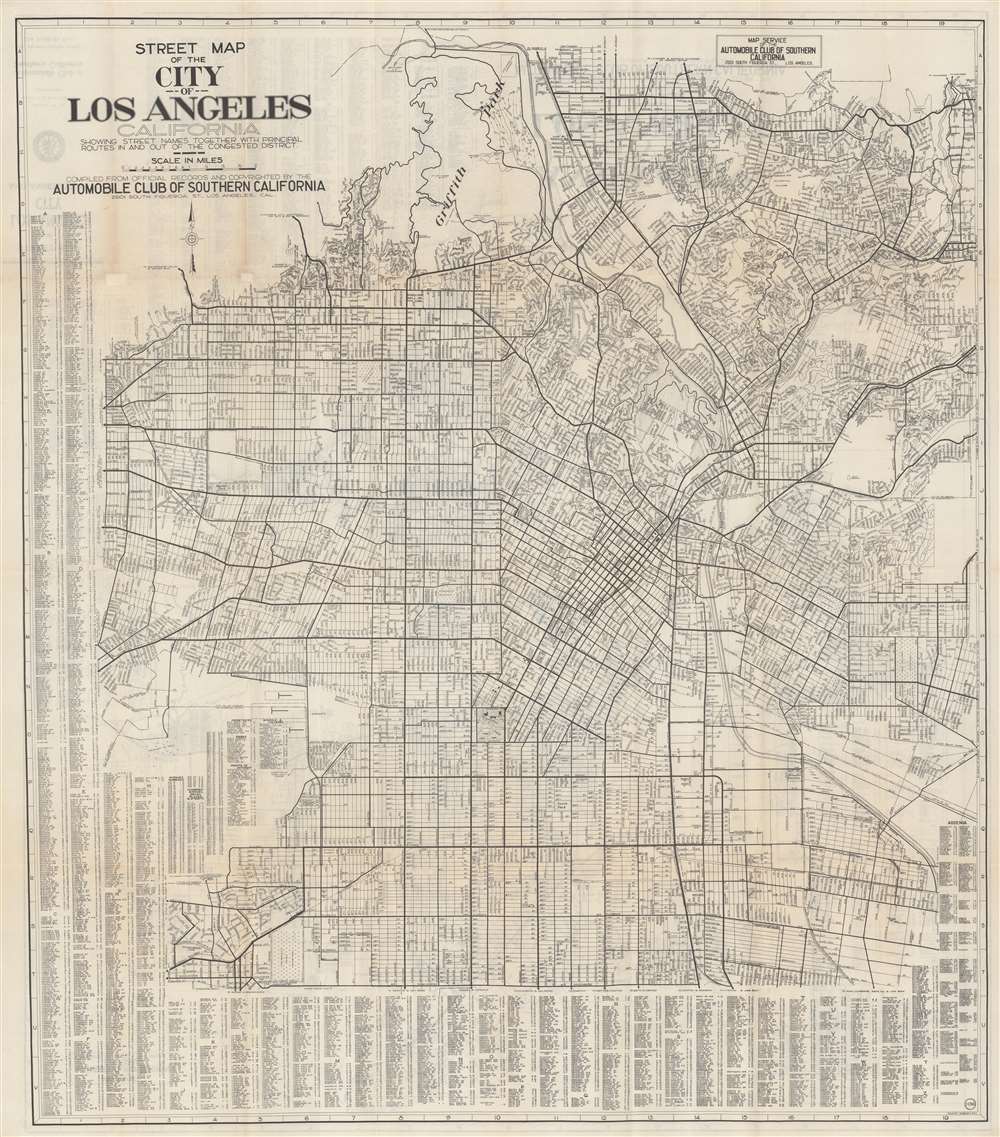
Depicting from Griffith Park to Manchester Avenue and from Doheny Road to Alhambra, the verso map covers central Los Angeles. Relatively few buildings are depicted, but those that appear include City Hall, the city jail, the Civic Center, the Union Pacific depot, and the University of Southern California.Publication History and Census
This map was created and published by the Automobile Club of Southern California c. 1933. We note five examples cataloged in OCLC, at Harvard University, the University of Chicago, the University of California Los Angeles, the California Historical Society, and Stanford University.
Cartographer
The Automobile Club of Southern California (1900 - Present) is an auto club based in Los Angeles, California and an affiliate of the American Automobile Association (AAA). Founded in 1900, it was one of the first auto clubs in the United States and was dedicated to proposing traffic laws, improving road conditions, and the overall improvement of driving conditions. The Auto Club began producing its own maps in 1910, when it sent out its own team of cartographers to survey the state's roads. Its main office at the corner of Figueroa Street and Adams Boulevard was completed in 1923. Numbering nearly 8 million members in its home territory alone, today it is the largest single member of the AAA federation More by this mapmaker...
Good. Toning and wear along original fold lines. Verso repair to a fold separations. Areas of infill at a few fold intersections and along top margin. Infill to both bottom corners. Map of Los Angeles on verso.
OCLC 1260301032, 27031903.