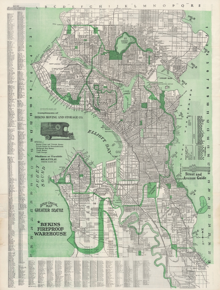
A large and detailed 1913 indexed folding map of Seattle, produced by the Seattle Engraving Company for Bekins Moving and Storage. It presents the city at a moment of self-confidence, when skyscrapers, public works projects, and the Alaska Yukon Pacific Exposition four years earlier announced its ambitions to the world.
A Closer Look
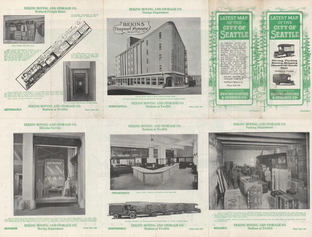
Highly detailed and thoroughly indexed, the map covers the entire city of Seattle and then some, with streets listed at left and bottom in accordance with the surrounding grid. A street and avenue guide at right clarifies the numbering and order of streets. Aside from roads, streetcars and interurban railways are denoted with dotted and bold black lines, respectively. Bekins' warehouse at 12th Ave. and Madison is represented with a green star; concentric circles emanate from it at one-mile intervals. Large numbers throughout indicate city wards. The verso includes photographs of Bekins facilities, promoting their convenience and safety. Sitting Pretty in Seattle
This map was published when Seattle was booming, in the wake of the Klondike Gold Rush and the Alaska Yukon Pacific Exposition in 1909. The gold rush had brought a flood of migrants to the city, helping it recover from a devastating fire in 1889. To accommodate the rapidly growing population, a range of ambitious public works projects were undertaken, including levelling some of the city's largest hills, digging a canal from Lake Washington to Puget Sound, and building the largest artificial island in the world at the time, Harbor Island, at the mouth of the Duwamish River. The firm of Frederick Law Olmsted was contracted to design impressive parks, linked by tree-line parkways running throughout the city. One year after this map's publication, Smith Tower was completed on Pioneer Square at Yesler Way and 2nd Ave.; it was the tallest building on the West Coast until the construction of the Seattle Space Needle in the 1960s.Publication History and Census
This map was produced by the Seattle Engraving Company for Bekins Moving and Storage in March 1913. Though not credited as such here, it appears to be based on a map published the previous year by the Kroll Map Company, an entirely plausible scenario given Kroll's predominance in the map publishing industry in Seattle. It is the earliest map of Seattle published for Bekins, which went on to sponsor maps of cities throughout the Western U.S. in the following decades. One other variant of the map exists, which is identical save for the image used below the copyright at left. In either case, the map is only noted among the holdings of the University of Washington and Washington State University.
Cartographer
Kroll Map Company (1911 - Present) is a Seattle-based map company. Founded in 1911 when Carl Kroll acquired both Anderson Map Company and Washington Map and Blueprint Company, both of which had been in business since the 1870s. From its inception, Kroll Map Company has ‘focused on mapping for real estate and local government, custom mapping, and the publication of numerous general mapping products.’ Carl Kroll sold a half-share of the company to John Loacker, his close friend and employee, in 1920. Loacker then purchased the company outright in 1925. He maintained the feel of a family business by working with his son Waldemar, who eventually took over. Waldemar J. Loacker (April 16, 1902 - February 12, 1995) worked at Kroll for the rest of his life, only leaving the company after suffering a stroke in 1992. Then his son John Loacker (b. 1955), who began working at Kroll in his youth, officially inherited the business and continues operating it to this day. In 1999, Kroll Map Company and Metsker Maps of Seattle formed a partnership of ‘two historic Seattle businesses.’ Today, the Kroll Map Company creates custom maps for individuals worldwide. More by this mapmaker...
Good. Wear along fold lines, with some splits and creases at edge and loss at fold intersections.
OCLC 1005991785.