
Kroll Map Company

Kroll Map Company (1911 - Present) is a Seattle-based map company. Founded in 1911 when Carl Kroll acquired both Anderson Map Company and Washington Map and Blueprint Company, both of which had been in business since the 1870s. From its inception, Kroll Map Company has ‘focused on mapping for real estate and local government, custom mapping, and the publication of numerous general mapping products.’ Carl Kroll sold a half-share of the company to John Loacker, his close friend and employee, in 1920. Loacker then purchased the company outright in 1925. He maintained the feel of a family business by working with his son Waldemar, who eventually took over. Waldemar J. Loacker (April 16, 1902 - February 12, 1995) worked at Kroll for the rest of his life, only leaving the company after suffering a stroke in 1992. Then his son John Loacker (b. 1955), who began working at Kroll in his youth, officially inherited the business and continues operating it to this day. In 1999, Kroll Map Company and Metsker Maps of Seattle formed a partnership of ‘two historic Seattle businesses.’ Today, the Kroll Map Company creates custom maps for individuals worldwide.
Great Expectations.
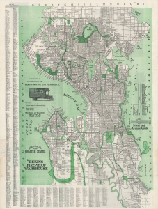
Latest Official Map, Greater Seattle / Latest Map of the City of Seattle.
$700.00
Acquire
- Digital Map Information
- Suitable for large format printing
- Full resolution TIFF file
- ICC color profile embedded
- Delivered instantly via download link
A large and detailed 1913 indexed folding map of Seattle, produced by the Seattle Engraving Company for Bekins Moving and Storage. It presents the city at a moment of self-confidence, when skyscrapers, public works projects, and the Alaska Yukon Pacific Exposition four years earlier announced its ambitions to the world. (more details)
Alaska just before the United States entered World War II.
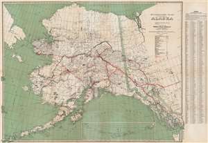
Standard Map of the Territory of Alaska.
$300.00
Acquire
- Digital Map Information
- Suitable for large format printing
- Full resolution TIFF file
- ICC color profile embedded
- Delivered instantly via download link
An impressive piece, this is a c. 1940 Kroll Map Company map of Alaska. The map illustrates the territory before it became a state (1959) and just prior to World War II (1939 - 1945), in which Alaska played a significant role. Coverage extends from Siberia to the Yukon Territory, and from the Arctic Ocean and the town of Barrow to Unalaska. Cities and towns are identified throughout, including Anchorage, Juneau, Seward, and Fairbanks. (more details)
Visually striking map of the Pacific Northwest.
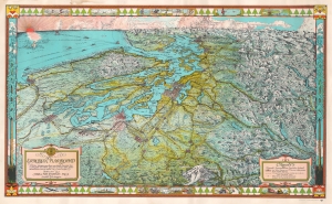
The Evergreen Playground. Neither Europe nor Asia nor South America has a prospect in which sea and woods and snow mountains are so united in a landscape.
$700.00
Acquire
- Digital Map Information
- Suitable for large format printing
- File Size: 47.48 MB
- File Type: ZIP / TIFF
- ICC color profile embedded
- Delivered instantly via download link
A stunning 1945 Kroll Map Company pictorial bird's-eye view map of the Pacific Northwest, the Puget Sound, and the surrounding region, including Seattle, Tacoma, and Olympia, Washington, and Vancouver, British Columbia. Oriented to the west-northwest, the map depicts from the Pacific Ocean to the mountains east of Seattle and from the Canadian Rockies north of Vancouver to Mount Rainier. Individual buildings in Seattle, Tacoma, Olympia, and Vancouver are illustrated, including the state capitol building in Olympia. The Seattle-Tacoma airport is also labeled. Both Olympic National Park and Mount Rainier National Park are depicted in detail, with several locations labeled within the park, such as Paradise Inn on the slopes of Mount Rainier. Other buildings in secluded areas are illustrated, among them the Big Four Inn, the Mt. Baker Lodge, and the Harrison Hot Springs. (more details)
Plutopia.
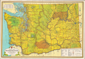
This is a colorful c. 1955 Kroll map of Washington State. Among other features, it is notable for highlighting the location of the Hanford Site, established during the Manhattan Project, the location of the first full-scale plutonium production reactor. (more details)