This item has been sold, but you can get on the Waitlist to be notified if another example becomes available, or purchase a digital scan.
1950s Knoll Map or Plan of the City of Seattle, Washington
Seattle-knoll-1950s$62.50

Title
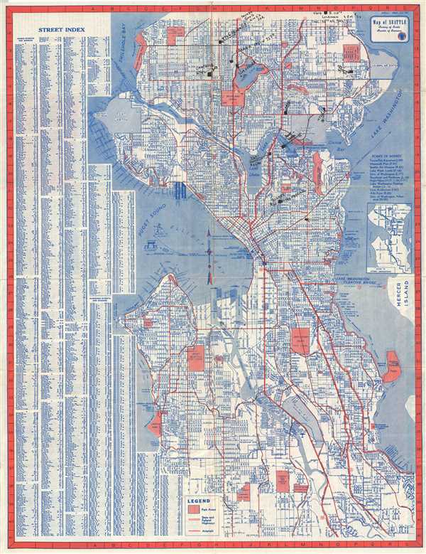
Map of Seattle.
1950s (undated) 21.5 x 17 in (54.61 x 43.18 cm) 1 : 46000
1950s (undated) 21.5 x 17 in (54.61 x 43.18 cm) 1 : 46000
Description
This is a detailed c.1950 map or city plan of Seattle, Washington by Kroll Map Co. Inc. Covers the entire city in incredible detail noting streets, parks, lakes, bridges, street car lines, rivers, proposed expansions, lakes, and other important topographical features. Points of interest are noted near the right border. Along the left border of the map, a street index is included. A small inset depicting the system of street designations.
Verso of the map includes a guide offering important facts, sightseeing trips, outdoor recreation, what to see, scenic drives and other useful tourist information. A map of downtown Seattle showing hotels, public buildings, clubs, and passenger terminals is also included. The map was issued by The Seattle Chamber of Commerce.
Verso of the map includes a guide offering important facts, sightseeing trips, outdoor recreation, what to see, scenic drives and other useful tourist information. A map of downtown Seattle showing hotels, public buildings, clubs, and passenger terminals is also included. The map was issued by The Seattle Chamber of Commerce.
Condition
Very good. Some wear along original fold lines and fold intersections. Manuscript markings in ink at places.