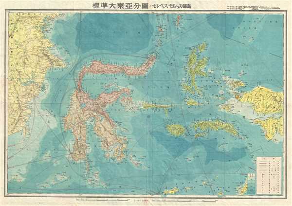
1943 or Showa 18 World War II Era Japanese Map of Sulawesi, Indonesia
Sulawesi-showa18-1943$250.00

Title
Indonesia.
1943 (undated) 30 x 21 in (76.2 x 53.34 cm) 1 : 3000000
1943 (undated) 30 x 21 in (76.2 x 53.34 cm) 1 : 3000000
Description
This is a scarce and beautiful 1943 or Showa 18 large format Japanese map of Sulawesi and the Maluku Islands of Indonesia. It covers from eastern Borneo east to include the islands of Sulawesi east as far as West Papua. It offers superb detail regarding both topographical and political elements. Notes cities, roads, trade routes on air, sea and land, and uses shading to display oceanic depths.
This map was created by the Japanese during World War II and issued as part of a 20 map Series of Great East Asia Maps, detailing parts of Asia and the Pacific. All text is in Japanese.
This map was created by the Japanese during World War II and issued as part of a 20 map Series of Great East Asia Maps, detailing parts of Asia and the Pacific. All text is in Japanese.
Condition
Very good. Minor wear along original fold lines. Minor toning and spotting. Accompanied by original cover no. 13.