1926 Horne City Plan or Map of Summerall Park Heights, Tavares, Florida
SummerallParkHeights-horne-1926$250.00

Title
Map of Summerall Park Heights A Subdivision of Parts of Secs. 31 and 32 T. 19S R. 26E. Tavares Lake County Florida.
1926 (dated) 12 x 12.25 in (30.48 x 31.115 cm) 1 : 2400
1926 (dated) 12 x 12.25 in (30.48 x 31.115 cm) 1 : 2400
Description
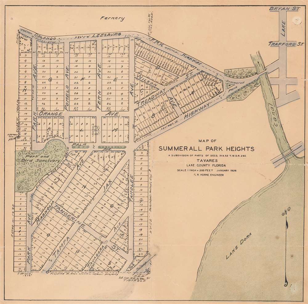
This is a 1926 C. R. Horne city plan or map of Summerall Park Heights, Tavares, Lake County, Florida. Depicting the subdivision in detail, individual lots are illustrated and numbered. Streets throughout are identified, although many do not exist in modern-day Summerall Park Heights. Some street names in common with today's subdivision are Fern Avenue, Pomelo Avenue, Palm Avenue, and Magnolia Avenue. The park and bird sanctuary marked on the map near the left border does not survive, but Summerall Park and the canal are both part of the modern-day subdivision. Part of Lake Dora occupies the lower right corner.
Publication History and Census
This map was created by C.R. Horne, likely the county engineer, in January 1926. We note a single cataloged example, part of the collection at the Touchton Map Library at the Tampa Bay History Center.Condition
Good. Exhibits wear along original fold lines. Closed tear extending three-quarters (.75) of an inch into lower right corner professionally repaired on verso. Infill to lower left margin corner.
References
Tampa Bay History Center, Touchton Map Library 2018.080.030.