1840 Black Map of Switzerland
Switzerland-black-1840$100.00

Title
Switzerland.
1840 (undated) 11.5 x 16 in (29.21 x 40.64 cm)
1840 (undated) 11.5 x 16 in (29.21 x 40.64 cm)
Description
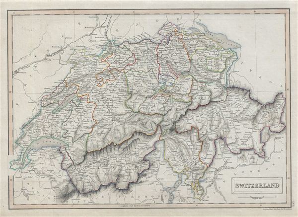
A fine example of Adam and Charles Black's 1840 map of Switzerland. The map covers the entire country and shows the division by Cantons from Vaud to Grisons. As this map was issued, Switzerland was undergoing a rapid social and economic change known as the Regeneration Movement. Following the French July Revolution in 1830, the Swiss began assemble and call for fair representation and new Cantonal constitutions. Many of the cantons subsequently established representative governments and instituted freedom of the press and trade. This map was engraved by S. Hall for issue in the 1840 edition of Black's General Atlas.
Cartographer
Charles and Adam Black (fl. 1807 - present) were map and book publishers based in Edinburgh. Charles and his uncle, Adam, both of Edinburgh, Scotland, founded their publishing firm in 1807. They published a series of maps and atlases throughout the 19th century. In addition to an array of atlases, the Black firm is known for their editions of the Encyclopedia Britannica (1817 - 1826) and the first publishing of Sir Walter Scott's novels in 1854. In 1889 the A. & C. Black publishing house moved to London where it remains in operation to this day. More by this mapmaker...
Source
Hall, Sydney, Black's General Atlas: A series of Fifty-Four Maps from the Latest and Most Authentic Sources, Engraved on Steel, In the First Style of the Art, (Edinburgh: Adam and Charles Black) 1840.
Condition
Very good. Blank on verso. Original platemark visible.
References
Rumsey 2305.024 (1854 edition). Philips (atlases) 4334.