Digital Image: 1834 Keller Pocket Map of Switzerland
Switzerland-keller-1834_d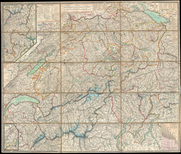

Title
Schweizerische Karten und Plane, Panorama und Ansichten
1834 (dated) 21.5 x 25.75 in (54.61 x 65.405 cm)
1834 (dated) 21.5 x 25.75 in (54.61 x 65.405 cm)
Description
FOR THE ORIGINAL ANTIQUE MAP, WITH HISTORICAL ANALYSIS, CLICK HERE.
Digital Map Information
Geographicus maintains an archive of high-resolution rare map scans. We scan our maps at 300 DPI or higher, with newer images being 600 DPI, (either TIFF or JPEG, depending on when the scan was done) which is most cases in suitable for enlargement and printing.
Delivery
Once you purchase our digital scan service, you will receive a download link via email - usually within seconds. Digital orders are delivered as ZIP files, an industry standard file compression protocol that any computer should be able to unpack. Some of our files are very large, and can take some time to download. Most files are saved into your computer's 'Downloads' folder. All delivery is electronic. No physical product is shipped.
Credit and Scope of Use
You can use your digial image any way you want! Our digital images are unrestricted by copyright and can be used, modified, and published freely. The textual description that accompanies the original antique map is not included in the sale of digital images and remains protected by copyright. That said, we put significant care and effort into scanning and editing these maps, and we’d appreciate a credit when possible. Should you wish to credit us, please use the following credit line:
Courtesy of Geographicus Rare Antique Maps (https://www.geographicus.com).
How Large Can I Print?
In general, at 300 DPI, you should at least be able to double the size of the actual image, more so with our 600 DPI images. So, if the original was 10 x 12 inches, you can print at 20 x 24 inches, without quality loss. If your display requirements can accommodate some loss in image quality, you can make it even larger. That being said, no quality of scan will allow you to blow up at 10 x 12 inch map to wall size without significant quality loss. For more information, it is best consult a printer or reprographics specialist.
Refunds
If the high resolution image you ordered is unavailable, we will fully refund your purchase. Otherwise, digital images scans are a service, not a tangible product, and cannot be returned or refunded once the download link is used.
Cartographer
Heinrich Keller (October 11, 1776 - September 18, 1862) was a Zurich based etcher, lithographer, cartographer and illustrator. Keller's father was a baker and in all likelihood Keller would have continued in the family business had not terrible fall down several flights of stairs left him with a complicated femur fracture. During the next several years, Keller was confined to crutches. Limited in his movement, the young Keller instead turned his attention to maps and sketching. Discovering himself to be a talented artist, he devoted himself to cartography, landscapes, physiognomies, and views. At 19, Keller took work as a colorist and art tutor with the well known Zurich print dealer Johann Heinrich Fussli. It was during his time with Fussli that Keller began to develop and audience for his travel guides, views and maps. Around 1817 Keller split with Fussli and set up his own small publishing firm in his Zurich home. He is known for an attractive c. 1827 map of Zurich and a supremely detailed 1834 wall map of Switzerland. Keller's panoramic views also have a considerable following. More by this mapmaker...