1953 U.S. Air Force Aeronautical Chart or Map of Tamgak Mountains, Agadez, Niger
TamgakMountains-usaf-1953$100.00

Title
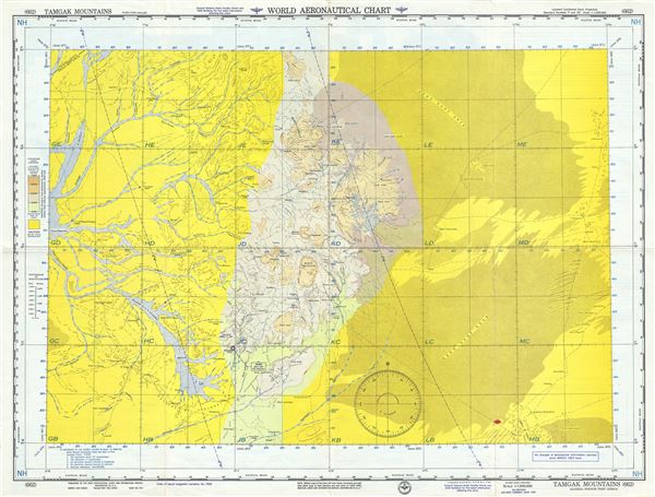
Tamgak Mountains Algeria-French West Africa.
1953 (dated) 22 x 29 in (55.88 x 73.66 cm) 1 : 1000000
1953 (dated) 22 x 29 in (55.88 x 73.66 cm) 1 : 1000000
Description
This is a fine 1953 U.S. Air Force aeronautical chart or map of the Adrar Tamgak or the Tamgak Mountains near Agadez in northern Niger. It covers the region from Aoukarri and the Algeria Niger border (then the Algeria French West Africa border) south to the Termit Massif or Termit Mountain. The cities of Agadez and Arlit are noted. The map is highly detailed, noting communes, valleys, mountains, deserts, rivers, dunes, cities and other hydrographical and topographical features essential for the air pilot. Verso of this chart features legends and a world aeronautical chart index. This chart was published by the USAF Aeronautical Chart and Information Service, Washington 25, D.C., and was issued as chart no. 662. First issued in 1945, this is the fourth edition revised to June 1953.
Condition
Very good. Minor wear and toning along original fold lines. Minor spotting in red.