Digital Image: 1876 Roessler Folding Geological Map of Texas
Texas-roessler-1876_d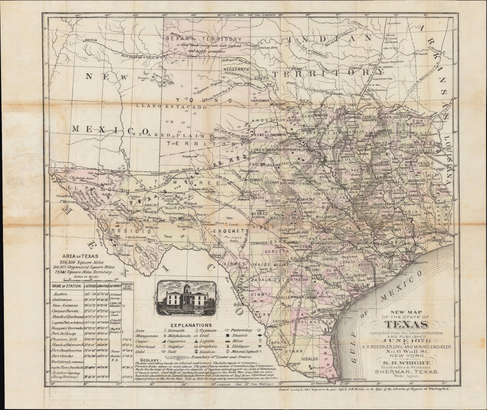
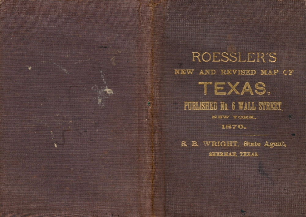

Title
New Map of the State of Texas compiled from the Latest Authorities and Published June 1876.
1876 (dated) 17.25 x 19.25 in (43.815 x 48.895 cm) 1 : 315000
1876 (dated) 17.25 x 19.25 in (43.815 x 48.895 cm) 1 : 315000
Description
FOR THE ORIGINAL ANTIQUE MAP, WITH HISTORICAL ANALYSIS, CLICK HERE.
Digital Map Information
Geographicus maintains an archive of high-resolution rare map scans. We scan our maps at 300 DPI or higher, with newer images being 600 DPI, (either TIFF or JPEG, depending on when the scan was done) which is most cases in suitable for enlargement and printing.
Delivery
Once you purchase our digital scan service, you will receive a download link via email - usually within seconds. Digital orders are delivered as ZIP files, an industry standard file compression protocol that any computer should be able to unpack. Some of our files are very large, and can take some time to download. Most files are saved into your computer's 'Downloads' folder. All delivery is electronic. No physical product is shipped.
Credit and Scope of Use
You can use your digial image any way you want! Our digital images are unrestricted by copyright and can be used, modified, and published freely. The textual description that accompanies the original antique map is not included in the sale of digital images and remains protected by copyright. That said, we put significant care and effort into scanning and editing these maps, and we’d appreciate a credit when possible. Should you wish to credit us, please use the following credit line:
Courtesy of Geographicus Rare Antique Maps (https://www.geographicus.com).
How Large Can I Print?
In general, at 300 DPI, you should at least be able to double the size of the actual image, more so with our 600 DPI images. So, if the original was 10 x 12 inches, you can print at 20 x 24 inches, without quality loss. If your display requirements can accommodate some loss in image quality, you can make it even larger. That being said, no quality of scan will allow you to blow up at 10 x 12 inch map to wall size without significant quality loss. For more information, it is best consult a printer or reprographics specialist.
Refunds
If the high resolution image you ordered is unavailable, we will fully refund your purchase. Otherwise, digital images scans are a service, not a tangible product, and cannot be returned or refunded once the download link is used.
Cartographer
Anton R. Roessler (c. 1833 - 1893) was a surveyor and cartographer who played an important role in the mapping of Texas in the early statehood period. Little is known about his early life aside from his being born in the Austro-Hungarian Empire. He arrived in Texas in the late 1850s and spent most of his adult life in Austin. He participated in the 'Shumard Survey,' led by the chief geologist of the state, Benjamin Franklin Shumard. Roessler worked as a geological assistant and draughtman on the survey, which was disbanded due to the Civil War in 1862 (Roessler's maps are the only ones that survive from the Shumard Survey). Roessler then worked as chief draughtsman for the Texas State Military Board's arsenal. Towards the end of the war, he shifted to the Union side, moving to New Orleans and informing federal troops about Confederate defenses and the geography of Texas. After the war, he worked for the U.S. Land Office (General Land Office) and began to publish maps of Texas and of individual counties of Texas under his own name. He also published scholarly papers related to geology and, for a time, relocated to New York, where he worked to promote immigration to Texas through the Texas Land and Immigration Company of New York. Mystery and controversy surrounded Roessler. The records of the Shumard Survey all were lost or destroyed, save for those in Roessler's possession. He was later publicly attacked by State Geologist S. B. Buckley, who accused Roessler of hoarding the only remaining copies of the Survey's maps and using them for personal gain. More by this mapmaker...