This item has been sold, but you can get on the Waitlist to be notified if another example becomes available, or purchase a digital scan.
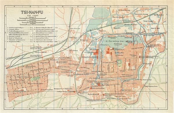
1924 Imperial Japanese Railway Map of Jinan or Chi-Nan-Fu or Tsi-Nan-Fu, China
Tsinanfu-japgovtrail-1924$100.00

Title
Tsi-Nan-Fu.
1924 (undated) 7 x 10.5 in (17.78 x 26.67 cm) 1 : 25000
1924 (undated) 7 x 10.5 in (17.78 x 26.67 cm) 1 : 25000
Description
This is a beautiful 1924 railway map or plan of Jinan or Chi-nan-fu (Chinan) or Tsi-nan-fu (Tsinan), the capital of Shandong province in China, issued by the Imperial Japanese Government Railways. It depicts the city of Jinan, referred to as the 'City of Springs,' in great detail, noting streets, individual streets, rivers, railways and other topography. Several railway lines are noted, including the Shantung Railway and the Tientsin Pukow Railway. This map was issued as part of the 1924 Official Series Vol. D of the Guide to China and printed at the Toppan Printing Company.
Source
Japanese Government Railways, Guide to China with land and sea routes between the American and European Continents, second (revised) edition, Tokyo, Japan, 1924.
Condition
Very good. Minor wear along fold lines.