1845 Ewing Map of Turkey in Asia
TurkeyAsia-ewing-1845$150.00

Title
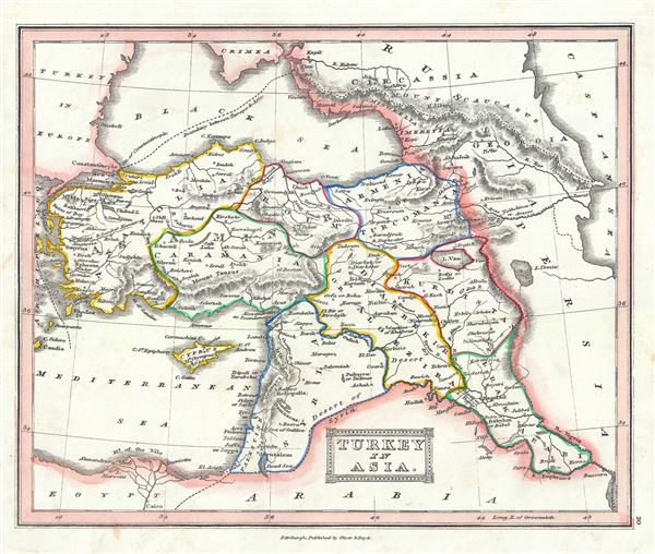
Turkey in Asia.
1845 (undated) 8 x 9.5 in (20.32 x 24.13 cm) 1 : 10000000
1845 (undated) 8 x 9.5 in (20.32 x 24.13 cm) 1 : 10000000
Description
This is a fine example of the 1845 Thomas Ewing map of Turkey in Asia. It covers from the Black Sea to Egypt, inclusive Cyprus. Centered on the Holy land (Palestine / Israel), the map covers the modern day countries of Turkey, Cyprus, Iraq, Israel, Palestine, Jordan, Lebanon, and Syria. Divided and color coded according to regions and territories, the map identifies various cities, towns, islands, rivers, and an assortment of additional topographical details. It dates to the last days of the Ottoman Empire, whose influence, though rapidly declining, still dominated much of the Middle East. This map was published in 1845 by Oliver and Boyd as part of Ewing's New General Atlas.
Source
Oliver and Boyd, Ewing's New General Atlas: containing Distinct Maps of all the Principal States and Kingdoms throughout the World, (Edinburgh) 1845.
Condition
Very good. Minor foxing at places. Blank on verso.