1938 U.S. Hydrographic Office Map of the North Pacific Prevailing Winds
UpperAirNorthPacific-hydrographic-1938$300.00

Title
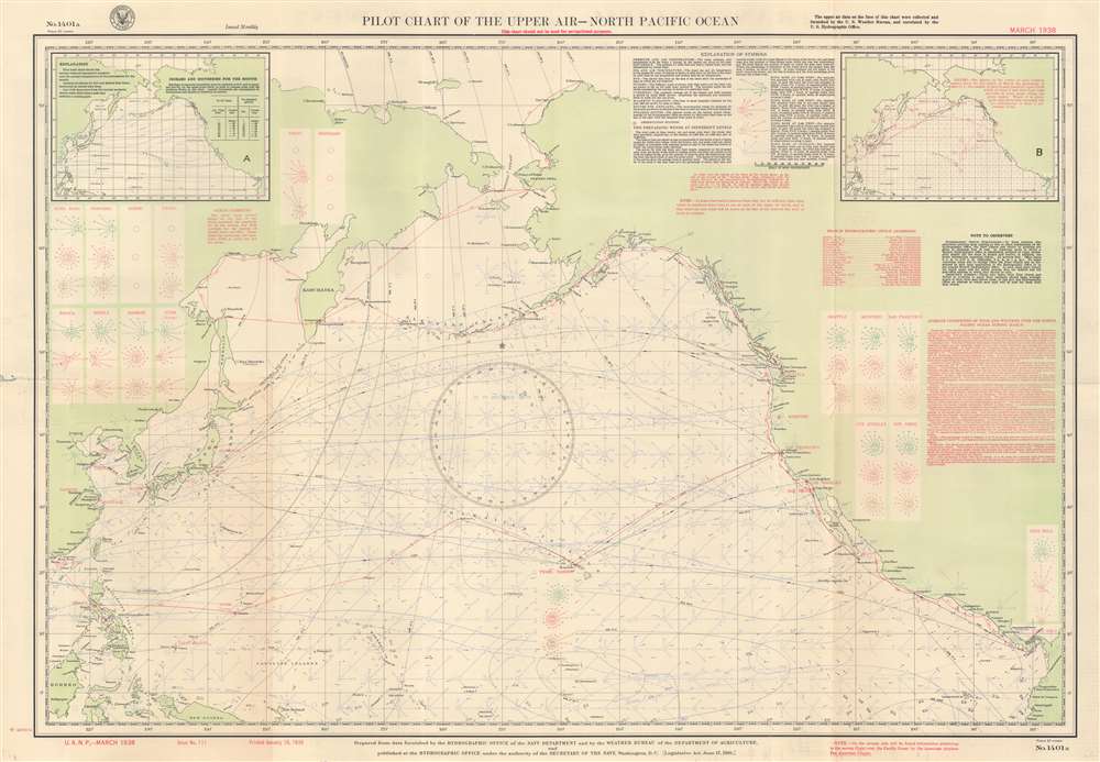
Pilot Chart of the Upper Air - North Pacific Ocean.
1938 (dated) 25.5 x 36.5 in (64.77 x 92.71 cm) 1 : 20000000
1938 (dated) 25.5 x 36.5 in (64.77 x 92.71 cm) 1 : 20000000
Description
This is a March 1938 U.S. Navy Hydrographic Office aeronautic map of the North Pacific detailing prevailing winds. Wind roses indicate what the wind at the surface averaged over 100 hours. Boxes on the left and right sides provide average wind readings at 2,500 feet, 5,000 feet, and 10,000 feet above major cities of the Pacific Rim, including Shanghai, Hong Kong, Manila, Seattle, Los Angeles, and San Diego. Red lines trace air routes, including the famed China Clipper route from San Francisco to Hong Kong via Honolulu, Midway, Wake, Guam, and Manila. An inset in the upper left presents isobars and isotherms for March 1938 and an inset in the upper right details gales for the month of March. Explanatory information occupies most of the upper right.
Verso Content
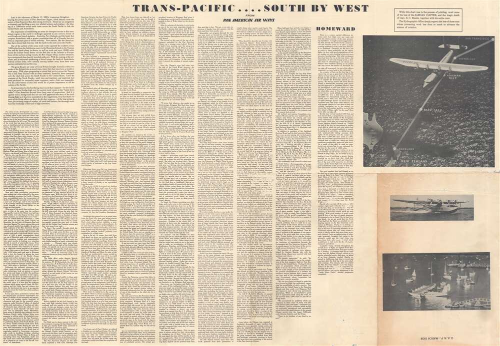
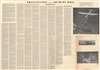
A narrative of the March 1937 trailblazing Pan American flight from San Francisco to Auckland, New Zealand occupies the verso. This narrative details the flight, its waypoints, and the establishment of a Transpacific aviation route to Australasia, a landmark achievement in civilian aviation.Publication History and Census
The U.S. Navy Hydrographic Office published Chart No. 1401 as early as 1895 on a monthly basis. Chart No. 1401a began being published on a monthly basis in January 1929. We have located cataloged examples of Chart No. 1401a dating from August 1931 (Issue No. 22) and April 1939 (Issue No. 124) along with the present example from March 1938.Cartographer
United States Hydrographic Office (1866 - 1962) was a brach of he U.S. Navy that prepared and published maps, charts, and nautical books to aid in navigation. Before the establishment of the Hydrographic Office in 1866, U.S. navigators were almost entirely dependent on British charts. There had been a few private enterprises that had prepared and published charts, but none had been able to do so profitably. The Office was established 'for the improvement of the means of navigating safely the vessels of the Navy and of the mercantile marine, by providing, under the authority of the Secretary of the Navy, accurate and cheap nautical charts, sailing directions, navigators, and manuals of instructions for the use of all vessels of the United States, and for the benefit and use of navigators generally.' This way the Navy Department could furnish navy and merchant ships with charts illustrating the results of surveys and explorations undertaken by naval officers. The charts were priced to cover the cost of paper and printing alone, not preparation. Its main objective was to survey foreign coasts, as the Coast and Geodetic Surveys were responsible for surveying domestic waters. The Hydrographic Office was transferred from the Department of the Navy to the Department of Defense in 1949 and was replaced by the Naval Oceanographic Office in 1962. More by this mapmaker...
Condition
Good. Wear along original fold lines. Slight loss at center with scuffing on verso. Text on verso.
References
OCLC 863608182.