1765 Isaak Tirion Map of Veracruz, Mexico

Veracruz-tirion-1765
$250.00
De Reede en Haven van Vera Cruz. - Main View
Processing...

1765 Isaak Tirion Map of Veracruz, Mexico

Veracruz-tirion-1765

Veracruz and its surroundings at the height of its wealth.
$250.00

Title


De Reede en Haven van Vera Cruz.
  1765 (undated)     7 x 10.5 in (17.78 x 26.67 cm)     1 : 116800

Description


This is a 1765 Isaak Tirion map of Veracruz, Mexico. The map depicts Veracruz from the point just north of Veracruz along the coastline to Anton Lizardo. Numerous reefs, islands, and other hazards are illustrated off the Mexican coast, including the island known as San Juan de UlĂșa, just off the coast from Veracruz. This was where Juan de Grijalva, the first Spanish explorer to arrive in the region, landed in 1518. The fortress labeled as Kasteel on the map was constructed on this island as well, in an effort to protect the city from pirates. As the premier port of export for gold and silver to Spain, Veracruz became a popular target for these sea-going rogues, thus the fort, and the subsequent construction of docks and a customs house to discourage smuggling. By the time this map was produced, Veracruz was the wealthiest and most important city in New Spain, even most prosperous than Mexico City.

This map was produced by Isaak Tirion and published in 1765.

Cartographer


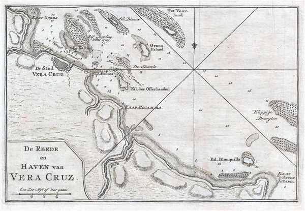
Isaak Tirion (1705 - 1765) was a Dutch publisher in Amsterdam. Born in Utrecht, Tirion quickly rose to prominence by publishing pamphlets, historical works, and most importantly, maps and atlases. He produced several atlases and Dutch town plans. His maps are mainly based on those of Guillaume de l'Isle. Tirion eventually relocated his printing house to the prestigious Kalverstraat. In his long career, he produced eight atlases in multiple editions, some of which were published posthumously until about 1784. More by this mapmaker...

Condition


Very good. Light wear along original fold lines. Blank on verso.