
Tirion, Isaak

Isaak Tirion (1705 - 1765) was a Dutch publisher in Amsterdam. Born in Utrecht, Tirion quickly rose to prominence by publishing pamphlets, historical works, and most importantly, maps and atlases. He produced several atlases and Dutch town plans. His maps are mainly based on those of Guillaume de l'Isle. Tirion eventually relocated his printing house to the prestigious Kalverstraat. In his long career, he produced eight atlases in multiple editions, some of which were published posthumously until about 1784.
Indies-Beyond-the-Ganges.
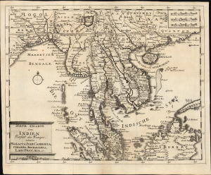
Neue Charte von Indien Jenseit des Ganges, nehmlich Malacca, Siam, Cambodia, Chiampa, Kochinchina, Laos Pegu, Ava, etc.
$750.00
Acquire
- Digital Map Information
- Suitable for large format printing
- File Size: 9.79 MB
- File Type: ZIP / TIFF
- ICC color profile embedded
- Delivered instantly via download link
This elegant c. 1732 map of Southeast Asia was produced by Jonas and David Korten. The map represents a period of ascendency for the Siamese monarchy, but also a period wherein much of this region was forbidden to Europeans and so largely unknown. (more details)
Uncredited Instance of the Strahlenberg cartography.
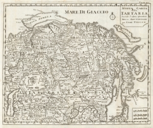
Nuova Carta della Tartaria Secondo l'Ultime Oservationi fata in Amsterdam per Isak Tirion.
$350.00
Acquire
- Digital Map Information
- Suitable for large format printing
- DPI: 600
- File Size: 23.73 MB
- File Type: ZIP / TIFF
- ICC color profile embedded
- Delivered instantly via download link
This is a 1740 Italian edition of Isaac Tirion's map of Tartary, or Russia in Asia. This is one of the few obtainable derivative maps to be based upon the little-known but groundbreaking cartography of Phillip Johann von Strahlenberg, created while he was a prisoner in Tobolsk. (more details)
Labels the home of the Dalai Lama and the Great Wall of China.
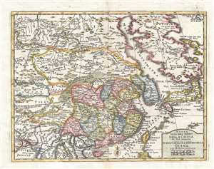
Nuova Carta dell'Imperio della China e dei Paesi circonvicini. / Nueva Carta de l'Imperio de la Quina u de la Tierras comarcanas.
$500.00
Acquire
- Digital Map Information
- Suitable for large format printing
- DPI: 300
- File Size: 4.02 MB
- File Type: ZIP / TIFF
- ICC color profile embedded
- Delivered instantly via download link
This is a 1744 Isaak Tirion map of East Asia including China, Japan, and Korea. The map depicts the region from Tibet and India to Japan and from Siberia and the Kamchatka Peninsula to Thailand, Laos, and Vietnam. Based on a map originally created by Guillaume ... (more details)
Securing the Spice Islands.
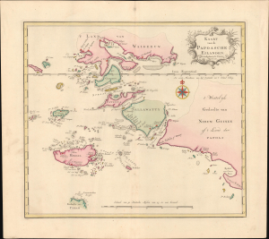
Kaart van de Papoasche Eilanden.
$275.00
Acquire
- Digital Map Information
- Suitable for large format printing
- File Size: 9.92 MB
- File Type: ZIP / TIFF
- ICC color profile embedded
- Delivered instantly via download link
This is Isaak Tirion's colorful 1753 Dutch map and nautical chart of the Dampier Strait, the Bird's Head Peninsula of West Papua, and the Raja Ampat Islands in what is now eastern Indonesia. The strategically important waterway was at the far edge of (indirect) Dutch colonial rule, but was crucial to Dutch hegemony over the Spice Islands. (more details)
Veracruz and its surroundings at the height of its wealth.
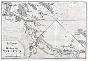
De Reede en Haven van Vera Cruz.
$250.00
Acquire
- Digital Map Information
- Suitable for large format printing
- DPI: 300
- File Size: 1.83 MB
- File Type: ZIP / TIFF
- ICC color profile embedded
- Delivered instantly via download link
This is a 1765 Isaak Tirion map of Veracruz, Mexico. The map depicts Veracruz from the point just north of Veracruz along the coastline to Anton Lizardo. Numerous reefs, islands, and other hazards are illustrated off the Mexican coast, including the island ... (more details)
Labels Grandes Rivières and Basse Pointe in approximately the same location where they are today.
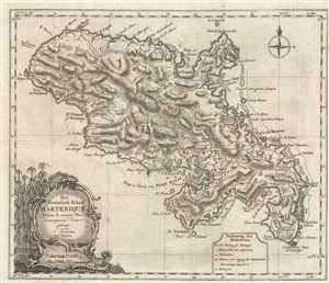
Het Westindisch Eiland Martenique Volgens de nieuwste Waar neemingen in Kaart gebragt.
$250.00
Acquire
- Digital Map Information
- Suitable for large format printing
- DPI: 300
- File Size: 5.92 MB
- File Type: ZIP / TIFF
- ICC color profile embedded
- Delivered instantly via download link
This is a c. 1765 Isaak Tirion map of the Caribbean island of Martinique. The map depicts the whole of the island from Grande Rivière to Pointe Varin and from St. Pierre of Roxelane to La Caravelle. Highly detailed, numerous locations are labeled both ... (more details)
Includes an inset map of Cayenne featuring the fortress, cathedral, and hospital.
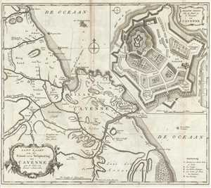
Land-Kaart van het Eiland en de Volkplanting van Cayenne aan de Kust van Zuid-Amerika.
$300.00
Acquire
- Digital Map Information
- Suitable for large format printing
- DPI: 300
- File Size: 7.24 MB
- File Type: ZIP / TIFF
- ICC color profile embedded
- Delivered instantly via download link
This is a 1767 Isaak Tirion map of Cayenne, French Guiana in South America. The map depicts the region along the northeastern coast of South America from the Kourou River past the city of Cayenne to the Kaw (Cau) River. The city of Cayenne is located ... (more details)
Labels Buenos Aires.
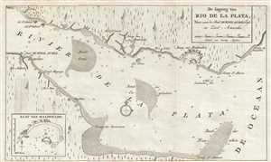
De Ingang van Rio de la Plata, Waar aan de Stad Buenos Ayres legt, in Zuid - Amerika.
$175.00
Acquire
- Digital Map Information
- Suitable for large format printing
- DPI: 300
- File Size: 2.63 MB
- File Type: ZIP / TIFF
- ICC color profile embedded
- Delivered instantly via download link
This is a 1767 Isaak Tirion map of the Rio de la Plata in South America. The map depicts the Rio de la Plata as it empties into the Atlantic Ocean, with modern-day Uruguay on the top and Argentina on the bottom. Today, the Rio de la Plata forms part ... (more details)
Includes a curious depiction of Lake Winnipeg.
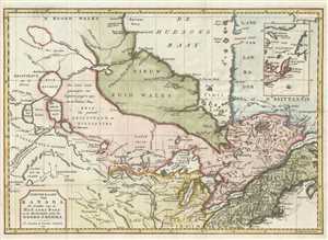
Nieuwe Kaart van Kanada, De Landen aan de Hudsons-Baay en de Noordwestelyke deelen van Noord-Amerika.
$550.00
Acquire
- Digital Map Information
- Suitable for large format printing
- DPI: 300
- File Size: 5.82 MB
- File Type: ZIP / TIFF
- ICC color profile embedded
- Delivered instantly via download link
This is a 1769 Isaak Tirion map of Canada and the northern United States. The map depicts the region from Hudson Bay to the middle of the modern-day United States and from Lake Winnipeg to Labrador and Nova Scotia. The territories of New North ... (more details)
Beautifully engraved New Orleans.
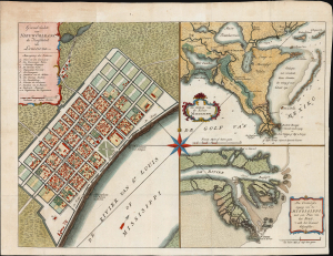
Grondvlakte van Nieuw Orleans, de hoofdstad van Louisiana. / De uitloop van de Rivier Missisippi. / De oostelyke ingang van de Missisippi, met een plan van het fort, 't welk het kanaal beheerscht.
$1,200.00
Acquire
- Digital Map Information
- Suitable for large format printing
- File Size: 15.96 MB
- File Type: ZIP / TIFF
- ICC color profile embedded
- Delivered instantly via download link
This is an attractive example of Isaak Tirion's 1769 map of New Orleans and the Mississippi River Delta: it is prized as one of the most beautiful 18th-century depictions of the city. Significantly, the map captures New Orleans as the center of Spanish Louisiana during a period of political transition. (more details)