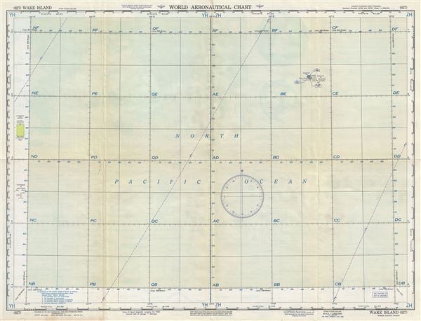
1956 U.S. Air Force Aeronautical Chart or Map of Wake Island, Pacific Ocean
WakeIsland-usaf-1956$100.00

Title
Wake Island North Pacific Ocean.
1956 (dated) 22 x 29 in (55.88 x 73.66 cm) 1 : 1000000
1956 (dated) 22 x 29 in (55.88 x 73.66 cm) 1 : 1000000
Description
This is a fine 1957 U.S. Air Force aeronautical chart or map of Wake Island in the Northern Pacific Ocean. It covers the coral atoll just north of Marshall Islands and the waters surrounding it. The Wake atoll is an unorganized, unincorporated territory of the United States managed by the United States Air Force. Verso of this chart features legends and a world aeronautical chart index. This chart was published by the USAF Aeronautical Chart and Information Service, Washington 25, D.C., and was issued as chart no. 627. First issued in 1949, this is the third edition revised to Aug 1956.
Condition
Very good. Minor wear and toning along original fold lines. Minor spotting.