1831 Dower / Teesdale Map of the Western Hemisphere

WesternHemisphere-teesdale-1831
$250.00
Western Hemisphere. - Main View
Processing...

1831 Dower / Teesdale Map of the Western Hemisphere

WesternHemisphere-teesdale-1831

Follow Captain Cook's voyages.
$250.00

Title


Western Hemisphere.
  1831 (dated)     14.25 x 13.75 in (36.195 x 34.925 cm)     1 : 62000000

Description


This is a beautifully colored 1831 Henry Teesdale / John Dower map of the Western Hemisphere published in their A New General Atlas of the World. The map predates the Mexican-American War, thus the United States does not include the modern-day American Southwest or Texas.
A Closer Look
North, Central, and South America immediately draw the viewer's attention. Cities are identified, including Quebec, Montreal, New York, Boston, Charleston, New Orleans, Veracruz, Havana, Caracas, Montevideo, Buenos Aires, Rio de Janeiro, and Valparaiso. Bays, capes, and other coastal features are labeled throughout. Islands are illustrated across the Pacific, such as Christmas Island and Owhyhee (Hawaii). Karakakooa Bay is marked as the site of Captain Cook's death on February 14, 1779. Lines trace Cook's voyages in the Atlantic and Pacific, with specific dates noted at a handful of positions.
Publication History and Census
Although not indicated on the sheet, this map was engraved by John Dower as the second plate in the 1831 edition of A New General Atlas of the World, published by Henry Teesdale. This appears to be a rare presentation of this map, as most examples from any edition of the atlas do not show such vivid and full color, only hand-colored outlines of territories. The 1831 edition of this map is independently cataloged in OCLC as being part of the holdings at the University of Chicago, the University of Texas at Arlington, the University of California Los Angeles, the Anchorage Museum, the University of Oxford, the National Library of New Zealand, and the National Library of Australia. The entire atlas is held by roughly one dozen institutions.

CartographerS


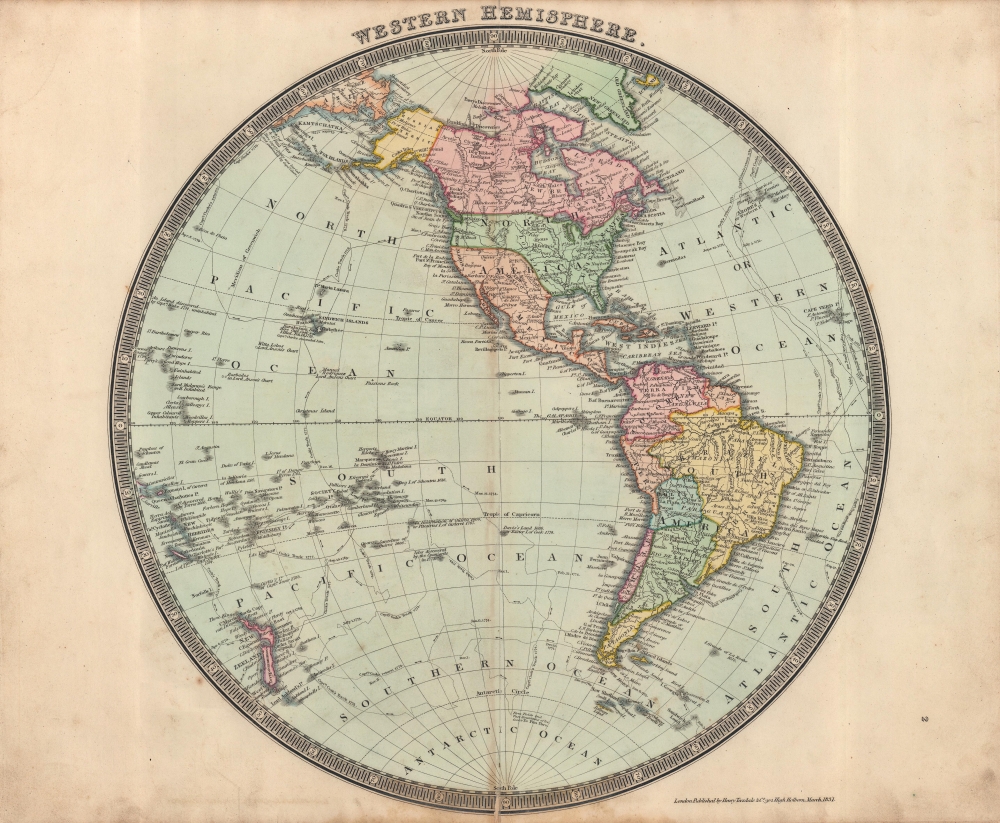
John James Dower (June 1, 1825 - 1901) was a well-respected mapmaker, print seller, and publisher based in London, England. Dower is the heir to the more prominent London engraver and mapmaker John Crane Dower (1791 - 1847). Dower worked with many prominent middle to late 19th century London map publishers including Weller, Cassell, Bacon, Petermann, and others. He was elected to the Royal Geographical Society in 1854. Dower also published on maps his own account including one atlas and various school geographies. In addition to his cartographic work, Dower is well known as an engraver of military scenes. More by this mapmaker...


Henry Teesdale (December 1776 - January 1856) was a British map publisher active in the first half of the 19th century. Teesdale was born in London. He was elected to the Royal Geographical Society in 1830. Teesdale initially partnered with John Hordan and William Colling Hobson as Henry Teesdale and Company, but this partnership was dissolved in 1832. Afterwards Teesdale continued to publish maps and atlases on his own account. He worked with several major British map engravers of the period including John Crane Dower, Christopher Greenwood, and Josiah Henshall, among others. His most prominent work is a large map of the world engraved by Dower. He must have enjoyed considerable commercial success because in 1845 he is registered as a partner in the Royal Bank of Scotland. Teesdale died in January of 1856 and was buried in All Souls, Kensal Green. Learn More...

Source


Dower, John, A New General Atlas of the World, (London: Teesdale) 1831.    

Condition


Good. Wear along original centerfold. Verso repairs to centerfold separations.

References


OCLC 43222767.