
Teesdale, Henry

Henry Teesdale (December 1776 - January 1856) was a British map publisher active in the first half of the 19th century. Teesdale was born in London. He was elected to the Royal Geographical Society in 1830. Teesdale initially partnered with John Hordan and William Colling Hobson as Henry Teesdale and Company, but this partnership was dissolved in 1832. Afterwards Teesdale continued to publish maps and atlases on his own account. He worked with several major British map engravers of the period including John Crane Dower, Christopher Greenwood, and Josiah Henshall, among others. His most prominent work is a large map of the world engraved by Dower. He must have enjoyed considerable commercial success because in 1845 he is registered as a partner in the Royal Bank of Scotland. Teesdale died in January of 1856 and was buried in All Souls, Kensal Green.
Brazil emerges as an empire.
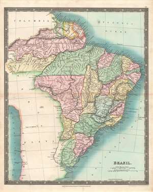
Brazil.
$300.00
Acquire
- Digital Map Information
- Suitable for large format printing
- DPI: 600
- File Size: 37.57 MB
- File Type: ZIP / TIFF
- ICC color profile embedded
- Delivered instantly via download link
This is a stunning example of the 1831 John Dower and Henry Teesdale map of Brazil and Guyana published in their A New General Atlas of the World. It depicts the region as it emerged from wars of independence against Spain and Portugal, when both borders and political systems were in flux. (more details)
Rome, Naples, and Messina.
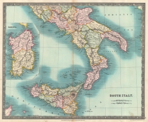
South Italy.
$425.00
Acquire
- Digital Map Information
- Suitable for large format printing
- DPI: 600
- File Size: 32.11 MB
- File Type: ZIP / TIFF
- ICC color profile embedded
- Delivered instantly via download link
This is an 1831 John Dower and Henry Teesdale map of southern Italy, then known as the Kingdom of the Two Sicilies. (more details)
A gorgeous map of a decidedly unpleasant place.
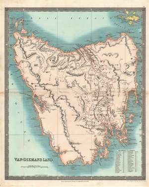
Van-Diemans Land.
$550.00
Acquire
- Digital Map Information
- Suitable for large format printing
- DPI: 600
- File Size: 40.59 MB
- File Type: ZIP / TIFF
- ICC color profile embedded
- Delivered instantly via download link
This is a brilliantly colored 1831 Henry Teesdale / John Dower map of Van Diemen's Land (Tasmania) published in their A New General Atlas of the World. It depicts the territory at a time when it primarily served as a British penal colony, gaining it a notorious reputation as an inhospitable and undesirable place. (more details)
A bright map of a rather dark period in Ottoman history.
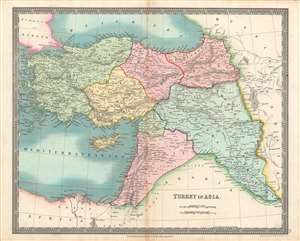
Turkey in Asia.
$300.00
Acquire
- Digital Map Information
- Suitable for large format printing
- DPI: 600
- File Size: 39.94 MB
- File Type: ZIP / TIFF
- ICC color profile embedded
- Delivered instantly via download link
This is a brilliantly colored 1831 Henry Teesdale / John Dower map of the 'Turkey in Asia,' that is, the Asian portion of the Ottoman Empire. This map was published as the Ottoman Empire faced both external and internal threats, and an acute existential crisis from within at the hands of Muhammed Ali Pasha, which the dynasty only survived thanks to a foreign intervention. (more details)
Follow Captain Cook's voyages.
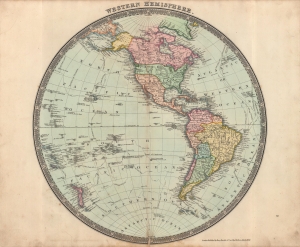
Western Hemisphere.
$250.00
Acquire
- Digital Map Information
- Suitable for large format printing
- DPI: 600
- File Size: 12.95 MB
- File Type: ZIP / TIFF
- ICC color profile embedded
- Delivered instantly via download link
This is a beautifully colored 1831 Henry Teesdale / John Dower map of the Western Hemisphere published in their A New General Atlas of the World. The map predates the Mexican-American War, thus the United States does not include the modern-day American Southwest or Texas. (more details)
Peru and Bolivia in the early years of independence.
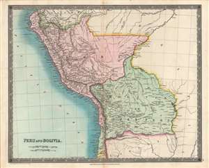
Peru and Bolivia.
$250.00
Acquire
- Digital Map Information
- Suitable for large format printing
- DPI: 600
- File Size: 36.89 MB
- File Type: ZIP / TIFF
- ICC color profile embedded
- Delivered instantly via download link
This is the Henry Teesdale / John Dower 1831 map of Peru and Bolivia published in A New General Atlas of the World. It depicts the titular countries and their neighbors as they emerged from Spanish rule and contended with internal and external conflicts over borders, social structures, and systems of government. (more details)
The Great Lakes.
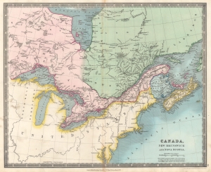
Canada, New Brunswick and Nova Scotia.
$200.00
Acquire
- Digital Map Information
- Suitable for large format printing
- DPI: 600
- File Size: 28.66 MB
- File Type: ZIP / TIFF
- ICC color profile embedded
- Delivered instantly via download link
This is an 1831 Henry Teesdale and John Dower map of Canada and the Great Lakes. (more details)
Names 'Alashka' for Alaska and 'Lions Land' in western Australia.
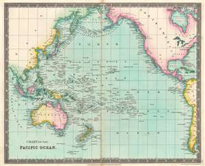
Chart of the Pacific Ocean.
$125.00
Acquire
- Digital Map Information
- Suitable for large format printing
- DPI: 600
- File Size: 29.92 MB
- File Type: ZIP / TIFF
- ICC color profile embedded
- Delivered instantly via download link
This is an 1831 Henry Teesdale map of the Pacific Ocean, with coverage extending from Asia to the Americas. Islands dot the map, including the Sandwich Islands and 'Owhyhee', the Society Islands, and the Friendly Islands. Unusual names and spellings populate the Pacific Northwest, including, from north to south, 'Alashka', New Norfolk, New Cornwall, New Hanover, and New Georgia. Intriguing regional names appear in Australia as well, such as 'Lions Land', 'Edels Land', 'Nuyts Land', and 'Endrachts Land'. (more details)