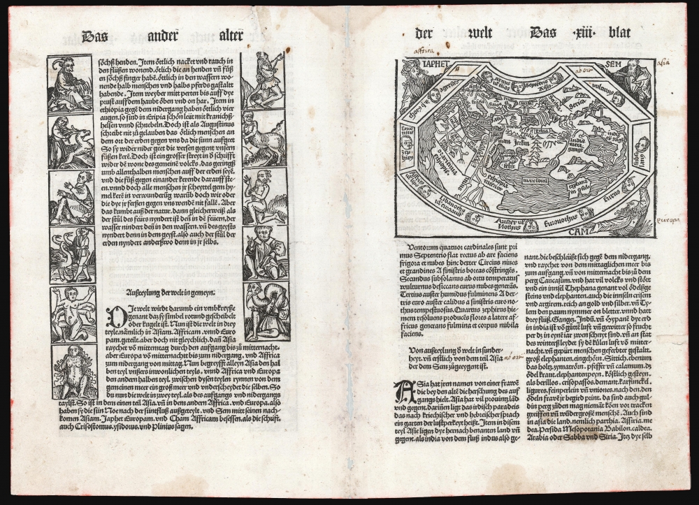
Digital Image: 1496 Schönsperger Map of the World after Schedel
World-schonsperger-1496_d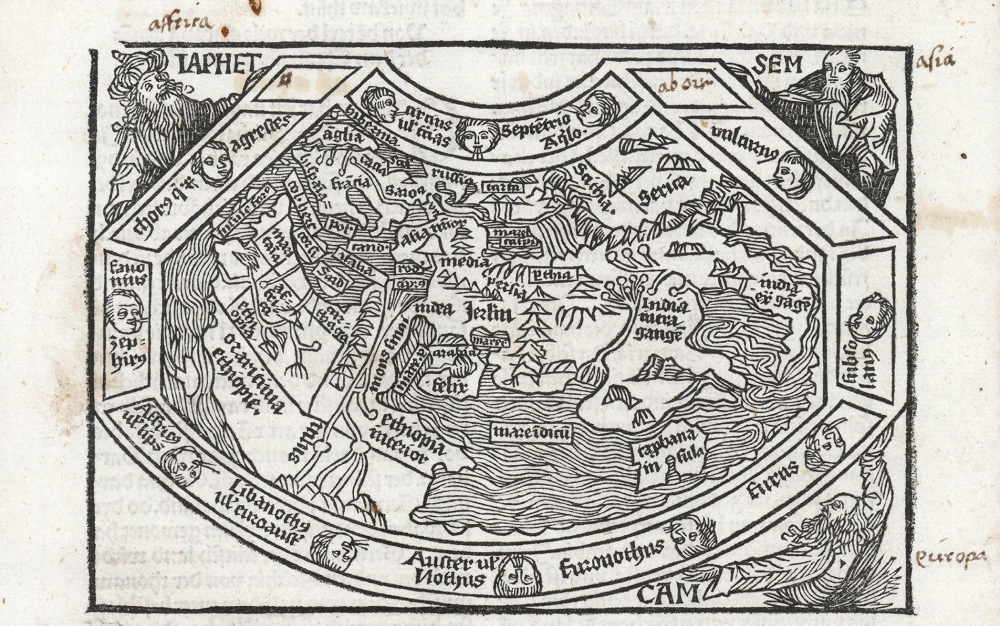

Title
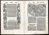
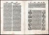
Der welt das xiii blat.
1496 (undated) 4 x 5.75 in (10.16 x 14.605 cm)
1496 (undated) 4 x 5.75 in (10.16 x 14.605 cm)
Description
FOR THE ORIGINAL ANTIQUE MAP, WITH HISTORICAL ANALYSIS, CLICK HERE.
Digital Map Information
Geographicus maintains an archive of high-resolution rare map scans. We scan our maps at 300 DPI or higher, with newer images being 600 DPI, (either TIFF or JPEG, depending on when the scan was done) which is most cases in suitable for enlargement and printing.
Delivery
Once you purchase our digital scan service, you will receive a download link via email - usually within seconds. Digital orders are delivered as ZIP files, an industry standard file compression protocol that any computer should be able to unpack. Some of our files are very large, and can take some time to download. Most files are saved into your computer's 'Downloads' folder. All delivery is electronic. No physical product is shipped.
Credit and Scope of Use
You can use your digial image any way you want! Our digital images are unrestricted by copyright and can be used, modified, and published freely. The textual description that accompanies the original antique map is not included in the sale of digital images and remains protected by copyright. That said, we put significant care and effort into scanning and editing these maps, and we’d appreciate a credit when possible. Should you wish to credit us, please use the following credit line:
Courtesy of Geographicus Rare Antique Maps (https://www.geographicus.com).
How Large Can I Print?
In general, at 300 DPI, you should at least be able to double the size of the actual image, more so with our 600 DPI images. So, if the original was 10 x 12 inches, you can print at 20 x 24 inches, without quality loss. If your display requirements can accommodate some loss in image quality, you can make it even larger. That being said, no quality of scan will allow you to blow up at 10 x 12 inch map to wall size without significant quality loss. For more information, it is best consult a printer or reprographics specialist.
Refunds
If the high resolution image you ordered is unavailable, we will fully refund your purchase. Otherwise, digital images scans are a service, not a tangible product, and cannot be returned or refunded once the download link is used.
Cartographer S
Johann (Hans) Schönsperger (c. 1455 - February 25, 1521) was a German printer and publisher living and working in Augsburg. Little is known of his youth or education. He set up a printing shop in 1481 in partnership with goldsmith Thomas Rüger and with his stepfather Johann Bämler. He would be the dominant publisher in Augsburg for the end of the fifteenth century, but would go bankrupt in 1507. He would be kept afloat by his appointment as court printer to Emperor Maxmilian I, publishing for him a highly regarded prayer book in 1513. Schönsperger is now remembered primarily for his Bibles, and for his abridged (and pirated) edition of Schedel's world chronicle. More by this mapmaker...
Hartmann Schedel (February 13, 1440 - November 28, 1514) was a German historian, physician, book collector, and humanist. He was among the first to reproduce a map using the printing press. He was born and died in Nuremberg. Little is known of his youth or education, although it is understood that the professor of philosophy and medicine, Matheolus Perusinus, was his tutor; he is thought to have studied in the university at Florence. Schedel is remembered for having written the 1493 Nuremberg Chronicle (Schedelsche Weltchronik in German, Liber Cronicarum in Latin.) As per its title, the book is a chronicle: it begins with a restatement of Biblical history reaching back to Creation before addressing the ancient world following the Biblical era, and recording more contemporary history - followed by a handful of pages left blank, in order that the reader should record the few years left of this sixth age of the world prior to the book's description of the seventh age of the world, that is to say the end of the world as presented in the Bible. Despite its adherence to this medieval form, the work would be the most lavishly illustrated work at the dawn of the Age of Discovery, and was an important conduit for the spread of humanistic learning north of the Alps. It included one of the first printed world maps, an excellent map of central Europe, and 29 full page city views representing the earliest realistic printed images of the cities they represented. Schedel was also a noted book and art collector: his private library is preserved in the Bayerische Staatsbibliothek in Munich, Germany. Learn More...
Claudius Ptolemy (83 - 161 AD) is considered to be the father of cartography. A native of Alexandria living at the height of the Roman Empire, Ptolemy was renowned as a student of Astronomy and Geography. His work as an astronomer, as published in his Almagest, held considerable influence over western thought until Isaac Newton. His cartographic influence remains to this day. Ptolemy was the first to introduce projection techniques and to publish an atlas, the Geographiae. Ptolemy based his geographical and historical information on the "Geographiae" of Strabo, the cartographic materials assembled by Marinus of Tyre, and contemporary accounts provided by the many traders and navigators passing through Alexandria. Ptolemy's Geographiae was a groundbreaking achievement far in advance of any known pre-existent cartography, not for any accuracy in its data, but in his method. His projection of a conic portion of the globe on a grid, and his meticulous tabulation of the known cities and geographical features of his world, allowed scholars for the first time to produce a mathematical model of the world's surface. In this, Ptolemy's work provided the foundation for all mapmaking to follow. His errors in the estimation of the size of the globe (more than twenty percent too small) resulted in Columbus's fateful expedition to India in 1492.
Ptolemy's text was lost to Western Europe in the middle ages, but survived in the Arab world and was passed along to the Greek world. Although the original text almost certainly did not include maps, the instructions contained in the text of Ptolemy's Geographiae allowed the execution of such maps. When vellum and paper books became available, manuscript examples of Ptolemy began to include maps. The earliest known manuscript Geographias survive from the fourteenth century; of Ptolemies that have come down to us today are based upon the manuscript editions produced in the mid 15th century by Donnus Nicolaus Germanus, who provided the basis for all but one of the printed fifteenth century editions of the work. Learn More...
Source
Schedel, H., Das Buch der Croniken...,(Augsburg: Schönsperger) 1496.
References
cf. OCLC 865113302. Shirley, Rodney W., The Mapping of the World: Early Printed World Maps 1472-1700, 20. Campbell, T. The Earliest Printed Maps, 221 ii.