
1985 Air Photo Services / Thomas Bros. Aerial Atlas of Orange County, California

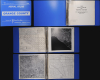

Aerial Atlas Orange County. / 1985 Aerial Atlas of Orange County.
The California Dream and Disneyland.
The California Dream and Disneyland.
This is a first edition example of an unusual aerial photographic atlas of Orange County, California, published in 1985 by Air Photo Services in conjunction with Thomas Brothers. It depicts the communities of Orange County in gorgeous detail, providing visual evidence of the tremendous population boom underway at the time.A Closer Look
The atlas covers the entirety of Orange County along with portions of Los Angeles, San Bernardino, Riverside, and San Diego Counties. An index map and photograph at the start of the atlas outline the portions of the county covered by the subsequent 54 sheets. Altogether covering the county as divided into equivalently-sized blocks (70, with some photos of rural areas covering more than one block). Each double-page pair of sheets includes a high-quality aerial photograph along with a map, drawn from Thomas Brothers' well-regarded commercial street atlas, indicating highways, streets, major topographic features, parks, schools, rail lines and stations, golf courses, airports, military bases, and other features. At the end of the atlas is a comprehensive street atlas of the entire county.Heartland of the 'California Dream'
Although its history has clearly been tied closely to both the city and county of Los Angeles to its north, Orange County maintains its own identity within the broader current of SoCal culture. In many ways, it exemplifies the Postwar era 'California Dream' of home ownership, job security, and enjoyment of 'eternal summer,' beaches, and mountains. The county's population growth in the decades after World War II (1939 - 1945) exploded from roughly 215,000 people in 1950 to more than 700,000 in 1960 and nearly 2,000,000 by 1980. Quaint new suburbs sprang overnight as one development after another was carved out of farmland to meet the housing demand. Cities like Anaheim and Irvine grew from almost nothing to hundreds of thousands of inhabitants by the end of the century, while small coastal communities like Newport Beach saw an equivalent population explosion. In recent decades, beginning around the time of this atlas' publication, additional areas of the county that were previously mostly rural and are considerably inland from the coast have seen similar growth, such as Mission Viejo (Sheets 29 B and D), El Toro (now Lake Forest, Sheet 51), and other cities around the Saddleback Valley.Disneyland
Perhaps nowhere in Orange County symbolizes its history and identity better than Disneyland, here at the bottom of Sheet 11 and the top of Sheet 16. Walt Disney originally planned to build an amusement park near his film studio in Burbank, but realized that his ambitions for the park required far more land, leading him to purchase 160 acres of farmland in Anaheim in 1953. He then sent out designers ('imagineers') to amusement parks across the country and world to gain inspiration and learn best practices, drawing a particularly strong influence from the Tivoli Gardens in Copenhagen. Construction began on July 16, 1954, and was completed a year later, with the park opening on July 17, 1955. Like the surrounding area, Disneyland has undergone significant changes since its opening, expanding and redesigning or replacing older and unpopular attractions, but its core design and spirit as 'the happiest place on Earth' has remained intact. It is the most visited amusement park in the world (over one billion visitors when counting the entire Disneyland Resort, including the California Adventure park opened in 2001), an international destination for travelers, and a central piece of Americana.Publication History and Census
This atlas was produced by Air Photo Services in conjunction with Thomas Brothers in 1985, the first edition of at least two published. The present edition of the atlas is noted among the holdings of four institutions in the OCLC, all located in Orange County itself: California State University Fullerton, Orange Coast College, the Newport Beach Public Library, and the Saddleback College Library.Cartographers
Air Photo Services (c. 1975 - 1999) was a Santa Ana, California-based company that specialized in taking high-quality aerial photographs for use by urban planners, real estate developers, and others. It should not be confused with a similar, contemporary Canadian company based in Alberta and later Edmonton. The company's best known works were aerial photo atlases of Orange County and Los Angeles County, produced in several editions in the mid-late 1980s in tandem with the California cartographic firm Thomas Bros. Further Details...
Thomas Brothers (1915 – 1999) was a prominent California-based English-American publisher specializing in maps and guidebooks. Founded in Oakland in 1915 by George Copeland Thomas, Guilbert Thomas, and Leonard Thomas, the company began modestly, selling maps of movie stars' homes from a Hollywood street corner, before developing into a major cartographic and guidebook publisher. Following George Thomas's death in 1955, his widow retained attorney Warren Wilson to organize the company's affairs. When none of the Thomas heirs expressed interest in continuing the business, Wilson and accountant Tom Tripodic purchased it, preserving the Thomas Brothers tradition while pursuing a new direction and eventually relocating the company's headquarters from San Francisco to Irvine, California. The firm prospered under Tripodic, growing to more than 200 employees and dominating the West Coast map market. Rand McNally acquired Thomas Brothers in 1999, laid off many of its experienced cartographers and employees in 2003, and closed the company's remaining California operations in 2009. Further Details...
Condition
Excellent. Book measures 11.5 x 14 in., individual sheets are 11 x 12 in.
References
OCLC 15620868.