1982 Ward Pictorial Map of North America Promoting Aérospatiale Helicopters.
AerospatialeHelicopters-ward-1982$750.00

Title
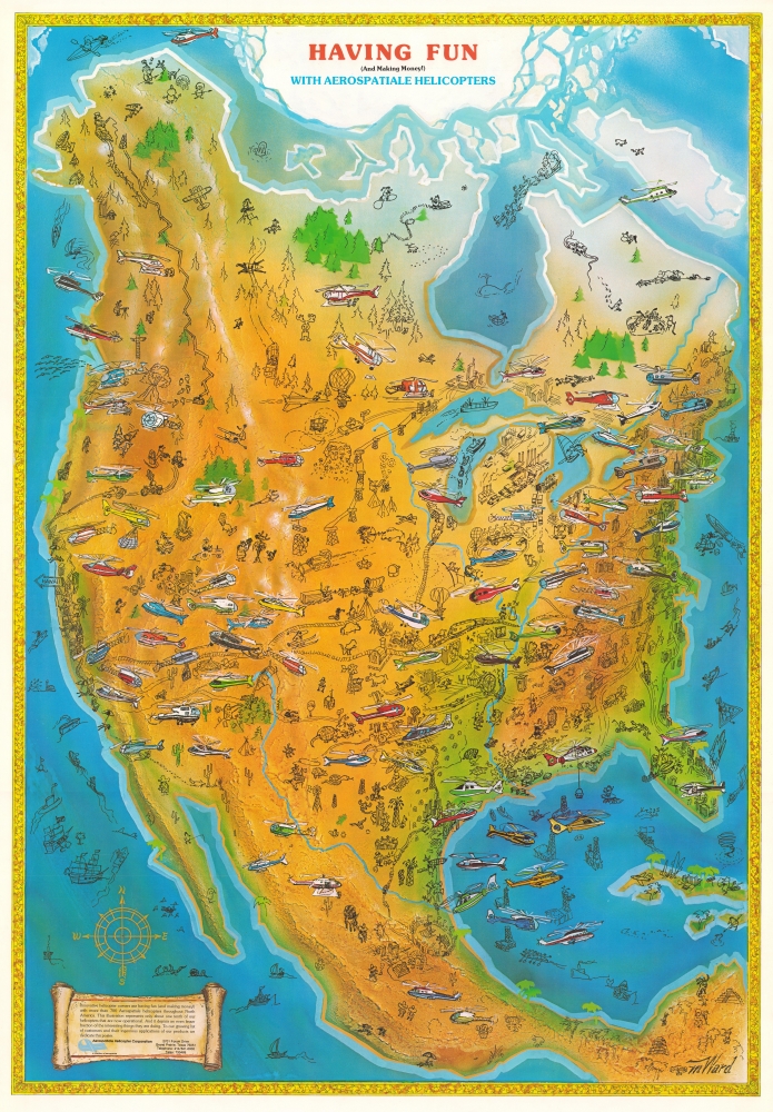
Having Fun (And Making Money!) With Aerospatiale Helicopters.
1982 (undated) 33.25 x 23 in (84.455 x 58.42 cm)
1982 (undated) 33.25 x 23 in (84.455 x 58.42 cm)
Description
This is a c. 1982 M. Ward pictorial map of North America published by the Texas division of Aérospatiale Helicopter Corporation. Capturing an ephemeral phase in modern aviation, this map promotes the novel idea that nearly anyone could buy, own, and make money with an Aérospatiale Helicopter.
This map is an advertisement for the helicopter industry, specifically Aérospatiale Helicopter. Text in the lower left corner promotes the private helicopter and suggests buyers open their own charter businesses. The caption states that there are 'more than 700 Aérospatiale helicopters throughout North America'.
A Closer Look
An array of Aérospatiale helicopters fills the sky over North America, itself richly illustrated with people, animals, places, and activities. Some are comical, including a semi truck in a standoff with a covered wagon in the Midwest, a rabbit being attacked by a tank in Texas, beachgoers fleeing a sea monster in Florida, and an unfortunate being chased by a polar bear on an Arctic island. Other illustrations include Santa Claus and his reindeer flying over Hudson Bay, New York's skyline, the Space Shuttle launching from Cape Canaveral, a bull fight in Mexico, and a Native American staring down a bison.This map is an advertisement for the helicopter industry, specifically Aérospatiale Helicopter. Text in the lower left corner promotes the private helicopter and suggests buyers open their own charter businesses. The caption states that there are 'more than 700 Aérospatiale helicopters throughout North America'.
Dating this Map
We arrived at the c. 1982 date we assigned to this piece through historical context. The French-owned Aérospatiale Helicopter Corporation opened its facility in Grand Prairie, Texas, in 1980, and alongside their phone number, they provide a Telex number. Fax machines quickly replaced Telex machines in the early 1980s, making this information obsolete. The inclusion of the volcanic eruption of Mount St. Helens also supports an early 1980s date.Publication History and Census
This map was drawn by M. Ward and published by the Aérospatiale Helicopter Corporation c. 1982. This map is not cataloged in OCLC or other institutional collections. We note only a handful of instances when it has appeared on the private market.Condition
Very good. Printed on glossy paper.