This item has been sold, but you can get on the Waitlist to be notified if another example becomes available.
1965 Afghan Tourist Organization Map of Afghanistan
Afghanistan-afghantourist-1965$700.00

Title
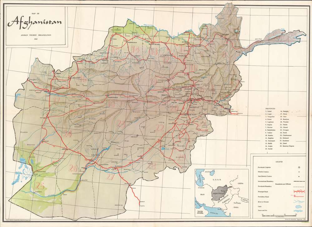
Map of Afghanistan.
1965 (dated) 20 x 27.5 in (50.8 x 69.85 cm) 1 : 2000000
1965 (dated) 20 x 27.5 in (50.8 x 69.85 cm) 1 : 2000000
Description
Recalling a time when Afghanistan was considered one of the most beautiful and welcoming countries in Central Asia, this is a 1965 Aminullah Dagarman and Afghan Tourist Organization map of Afghanistan. This map of Afghanistan depicts the entire country, then known as the 'Garden of Asia'. Thick red lines trace the principal roads, which connect major cities, including Kabul, Ghazni, Kandahar, and Herat. Distances between cities (in kilometers) appear as well. Towns and villages of all sizes are labeled throughout, along with mountain passes, rivers, and lakes. Afghanistan's twenty-nine provinces are labeled numerically and correspond with a table situated along the right border. Subtle artistic designs evoke Afghanistan's incredible terrain, and two green areas hint at the importance of the Helmand and Amoo Darya rivers for Afghanistan's agricultural industry.
Publication History and Census
This map was drawn by Aminullah Dagarman and published in 1965 by the Afghan Tourist Organization. Scarce on the market.Condition
Very good. Exhibits light wear along original fold lines. Verso repair to minor fold separation. Some very light foxing.
References
OCLC 5568250.