1872 Wyld Military Staff Map of Afghanistan - Second Anglo-Afghan War / Great Game
AfghanistanStaffMap-wyld-1879$2,500.00


Title
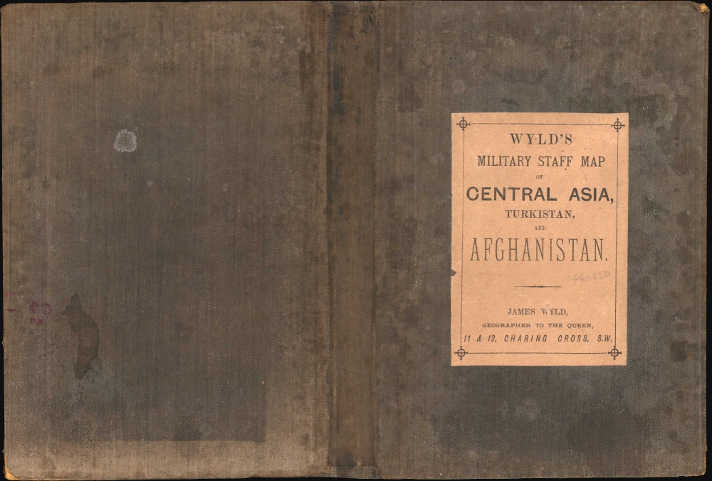
Wyld's Military Staff Map of Central Asia and Afghanistan.
1879 (undated) 36.25 x 48 in (92.075 x 121.92 cm) 1 : 2027520
1879 (undated) 36.25 x 48 in (92.075 x 121.92 cm) 1 : 2027520
Description
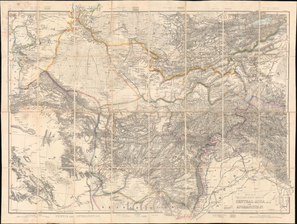
This is James Wyld II's exceptional 1879 large-scale Military Staff Map of Afghanistan, issued for government and military planning at the height of the Second Anglo-Afghan War (1878 - 1880), part of the Great Game. Like Wyld's other 'military staff maps', this map was not part of his prolific commercial output, but rather made directly from the best government and private sources for the use of military commanders and strategists in the field.
The Russian Empire, outlined in yellow, dominates the top of the map, as the British Indian Empire, outlined in red, occupies the bottom. Between are the Khanates, outlined in orange, both of which were protectorates of Russia: Bukhara in 1868 and Khiva in 1873. This left only the troublesome and independent Afghanistan between the Russian Empire and India, the jewel of the British Empire. Both the Russians and the British were dogged in their attempts to lure the Afghans to their cause, either through conquest or diplomacy, leading to several prior wars, including the First Anglo-Afghan War (1838 - 1842).
British connections with Punjab and Peshawar view the Punjab Northern State Railway are shown. Although not extending into Afghanistan, the railroad made it easier for the British to quickly move troops from throughout the subcontinent to the Afghan border. The Russian Empire had no similar access, giving the British a decided military advantage in Afghanistan, likely the reason Russia relied on diplomacy and proxy wars while the British resorted to full-scale invasion.
Nonetheless, a combination of fierce cultural independence, poorly mapped mountainous terrain (as evident here), and a deeply engrained militarism resulting from centuries of inter-tribal strife proved an intransigent barrier to European imperialists.
A Closer Look
The map illustrates the tense political situation at the height of the Great Game and the Second Anglo-Afghan War. Coverage here extends from Persia (also in play) and the Caspian Sea to southwestern China and the Karakorum Pass, and from the Aral Sea to Baluchistan and Sind. In addition to Afghanistan, it incorporates present-day Turkmenistan, Tajikistan, Kyrgyzstan, and Uzbekistan, as well as eastern Persia, and parts of Baluchistan (Pakistan), India, and China.The Russian Empire, outlined in yellow, dominates the top of the map, as the British Indian Empire, outlined in red, occupies the bottom. Between are the Khanates, outlined in orange, both of which were protectorates of Russia: Bukhara in 1868 and Khiva in 1873. This left only the troublesome and independent Afghanistan between the Russian Empire and India, the jewel of the British Empire. Both the Russians and the British were dogged in their attempts to lure the Afghans to their cause, either through conquest or diplomacy, leading to several prior wars, including the First Anglo-Afghan War (1838 - 1842).
British connections with Punjab and Peshawar view the Punjab Northern State Railway are shown. Although not extending into Afghanistan, the railroad made it easier for the British to quickly move troops from throughout the subcontinent to the Afghan border. The Russian Empire had no similar access, giving the British a decided military advantage in Afghanistan, likely the reason Russia relied on diplomacy and proxy wars while the British resorted to full-scale invasion.
Nonetheless, a combination of fierce cultural independence, poorly mapped mountainous terrain (as evident here), and a deeply engrained militarism resulting from centuries of inter-tribal strife proved an intransigent barrier to European imperialists.
The Second Anglo-Afghan War (1878 - 1880)
Part of the wider Great Game, the Second Anglo-Afghan War (1878 - 1880) was a conflict between the British Empire and the Emirate of Afghanistan, triggered by British fears of Russian expansion into Central Asia and the desire to secure a friendly, or at least compliant, regime in Afghanistan. The war began when the British, suspecting Afghan Amir Sher Ali Khan (1825 - 1879) of aligning with the Russians, demanded the establishment of a British mission in Kabul. The Amir's refusal led to the British invasion of Afghanistan in November 1878. Despite early victories and the initial capture of Kabul and Kandahar, the British faced fierce guerrilla resistance, leading to a protracted and costly campaign. The conflict concluded with the 1879 Treaty of Gandamak, where the British achieved some of their strategic objectives, including the control of Afghan foreign affairs, but it also left Afghanistan with significant internal autonomy. The war underscored the complexities of Afghan politics and terrain, and the limits of British military power in the region, setting the stage for further conflicts.The Great Game
'The Great Game' was a diplomatic confrontation between the British and Russian Empires over Afghanistan and other territories in Central and Southern Asia. The conflict, rooted in long-standing animosity between Russia and Britain, revolved around Afghanistan, which, while lacking significant resources of its own, was strategically situated. For its part, Russia feared Britain was making commercial and military inroads into Central Asia, an area long within the sphere of influence of St. Petersburg. Britain, conversely, feared Russia making gains in India, 'the jewel in the crown' of British Asia. The escalating tensions led to several wars and proxy wars: The First Anglo-Afghan War (1839 - 1842), the First Anglo-Sikh War (1845 - 1846), the Second Anglo-Sikh War (1848 - 1849), and the Second Anglo-Afghan War (1878 - 1880), along with the Russian annexations of Khiva, Bukhara, and Kokand. Then as now, Afghanistan proved a grinding stone upon which the world's great empires diminished themselves, none achieving a definitive victory despite committing staggering resources. The Great Game 'ended' on September 10, 1895, with the signing of the Pamir Boundary Commission Protocols, which stabilized the border between Afghanistan and the Russian Empire - but in truth, the conflict persisted well into the 20th century. Regarding the attitude of Afghans toward the British and Russians, the general assumption of the British was that 'Some will fight for us, some against us, but all will fight.Publication History and Census
This map was designed, engraved, and published by James Wyld II in London. Although there is no printed date, most scholarship apply a date of 1878-1879, at the height of the Second Anglo-Afghan War. The map is represented in several institutions, but a complete census has proven difficult due to a proliferation of digitized holdings on OCLC. Rare on the market.Cartographer
Wyld (1823 - 1893) was a British publishing firm active throughout the 19th century. It was operated by James Wyld I (1790 - 1836) and his son James Wyld II (November 20, 1812 - 1887) were the principles of an English mapmaking dynasty active in London during much of the 19th century. The elder Wyld was a map publisher under William Faden (1749 - 1836) and did considerable work on the Ordinance Survey. On Faden's retirement in 1823, Wyld took over Faden's workshop, acquiring many of his plates. Wyld's work can often be distinguished from his son's maps through his imprint, which he signed as 'Successor to Faden'. Following in his father's footsteps, the younger Wyld joined the Royal Geographical Society in 1830 at the tender age of 18. When his father died in 1836, James Wyld II was prepared to fully take over and expand his father's considerable cartographic enterprise. Like his father and Faden, Wyld II held the title of official Geographer to the Crown, in this case, Queen Victoria. In 1852, he moved operations from William Faden's old office at Charing Cross East (1837 - 1852) to a new, larger space at 475 Strand. Wyld II also chose to remove Faden's name from all of his updated map plates. Wyld II continued to update and republish both his father's work and the work of William Faden well into the late 1880s. One of Wyld's most eccentric and notable achievements is his 1851 construction of a globe 19 meters (60 feet) in diameter in the heart of Leicester Square, London. In the 1840s, Wyld also embarked upon a political career, being elected to parliament in 1847 and again in 1857. He died in 1887 following a prolific and distinguished career. After Wyld II's death, the family business was briefly taken over by James John Cooper Wyld (1844 - 1907), his son, who ran it from 1887 to 1893 before selling the business to Edward Stanford. All three Wylds are notable for producing, in addition to their atlas maps, short-run maps expounding upon important historical events - illustrating history as it was happening - among them are maps related to the California Gold Rush, the New South Wales Gold Rush, the Scramble for Africa, the Oregon Question, and more. More by this mapmaker...
Condition
Very good. Some foxing and glue stains, upper left panel. Accompanies original binder.
References
OCLC 1176663317.