This item has been sold, but you can get on the Waitlist to be notified if another example becomes available.
1957 Air France Pictorial Air Route Map of Africa
AfricaPictorial-airfrance-1957$450.00

Title
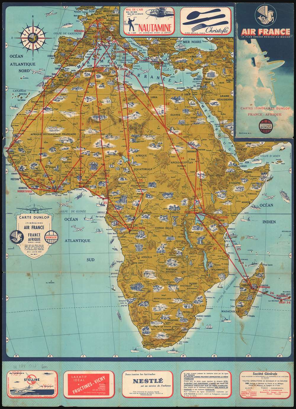
Carte Dunlop Itinéraires Air France France Afrique.
1957 (dated) 29.75 x 21.5 in (75.565 x 54.61 cm) 1 : 650000
1957 (dated) 29.75 x 21.5 in (75.565 x 54.61 cm) 1 : 650000
Description
An uncommon 1957 pictorial map of Africa issued for Air France by Dunlop. The attractive map highlights the cultural and natural wonders of Africa pictorially with red overprinting highlighting air-route operated by Air France. Red routes connect major hubs, with their airports noted: Yofe in Dakar, Robertsfield in Monrovia, Maya Maya in Brazzaville, etc. Although more beautiful than most, this map is part of a series of travel maps popular in the 1950s known as the 'Itinerarie Dunlop,' illustrating tours and air travel throughout Air France's coverage area.
Publication History
This map was created and published by Dunlop for Air France in 1957.Condition
Good. Exhibits soiling and wear, particularly along original fold lines. Text and printed advertisements on verso.