1950 Claude Dohet / Sabena Airlines Pictorial Map of Africa
AfricaSabena-dohet-1950-3$1,800.00


Title
Sabena Belgian World Airlines.
1950 (undated) 36.25 x 22 in (92.075 x 55.88 cm) 1 : 17700000
1950 (undated) 36.25 x 22 in (92.075 x 55.88 cm) 1 : 17700000
Description
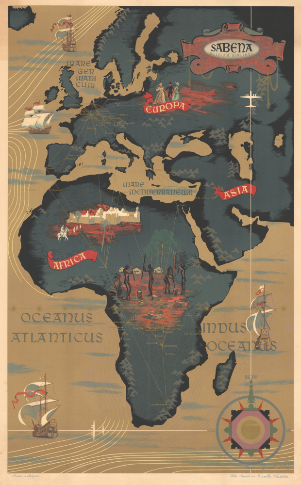
An attractive c. 1950 Claude Dohet art deco map of Africa and Europe advertising Sabena Airlines, the Belgian national carrier. The map features striking gold highlighting of air routes connecting Africa with Europe. It captures the mystique of Africa and the Congo, specifically, at the height of the 'African Queen' era.
Stylistically, Dohet's map recalls Belgium's cartographic heritage with Renaissance-style cartouche work evocative of Mercator and Ortelius, 18th-century ships, and an elaborate compass rose. It is further elaborated by pictorial illustrations of European and Congolese people, and a dramatic illustration of what might be Kano, Nigeria, at its height.
A Closer Look
Coverage embraces all of Europe, including the British Isles, Scandinavia, and parts of Iceland, as well as Asia as far east as the Aral Sea, including all of Arabia, and the full continent of Africa. Gold highlighting promotes Sabena Airways routes from Europe to Africa and throughout Africa, connecting as far as Dar-Es-Salaam and Johannesburg.Stylistically, Dohet's map recalls Belgium's cartographic heritage with Renaissance-style cartouche work evocative of Mercator and Ortelius, 18th-century ships, and an elaborate compass rose. It is further elaborated by pictorial illustrations of European and Congolese people, and a dramatic illustration of what might be Kano, Nigeria, at its height.
Sabena Airlines and Central Africa
In the middle of the 20th century, Sabena maintained one of the largest air networks in Central Africa (then the Belgian Congo), with regular flights between Brussels, Kano, and Stanleyville, along with other destinations. During this era, Stanleyville (Kisangani) was the darling of the Belgian Congo, where Audrey Hepburn and Humphrey Bogart filmed 'The African Queen' (1951). Just ten years later, following Congolese independence, Stanleyville devolved into a battleground and remained so for the next 20 years.Publication History and Census
This map was drawn by Claude Dohet and printed in Brussels, Belgium, c. 1950 by Litho Linsmo. We note only a handful of surviving examples that have appeared on the private market. Scarce in collections.Condition
Very good. A few minor edge stabilizations. Slight toning.
References
Rumsey 9692.000.