1965 William Johnson Jr. Hand-Colored Pictorial Map of Andros Island, Bahamas
AndrosIsland-johnsonjr-1965$2,500.00

Title
Andros Island.
1965 (undated) 19.75 x 13 in (50.165 x 33.02 cm) 1 : 376000
1965 (undated) 19.75 x 13 in (50.165 x 33.02 cm) 1 : 376000
Description
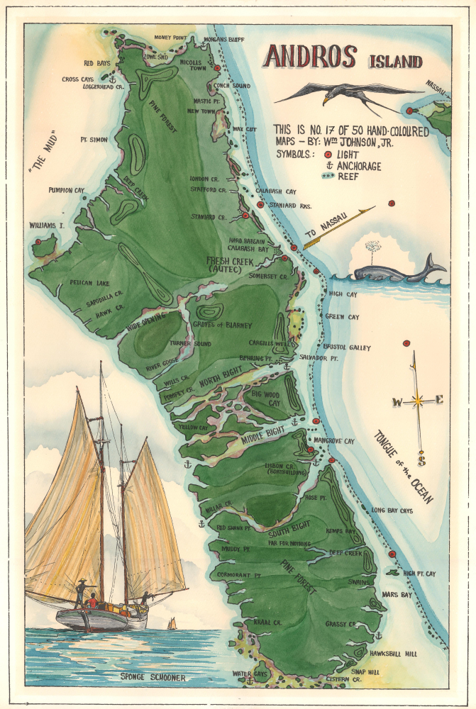
This is a c. 1965 William Johnson Jr. hand-colored limited-edition map of Andros Island, Bahamas. Johnson Jr.'s color work displays virtuosic talent, making this piece exceptional.
A Closer Look
Andros Island occupies nearly the entire sheet, with Nassau just beyond the map's scope to the east. Creeks, bights, cays, points, and other coastal features are identified. Nicholls Town is labeled. Anchors mark the few safe harbors, and small crosses emphasize the reefs lining nearly the entire east side of the island. Red circles with black dots mark lights. A frigate bird and a whale appear to the right of the island, and a large illustration of a sponge schooner adorns the lower left corner.Andros Island
Andros Island is the largest island in the Bahamas and is technically an archipelago since it is fragmented by many bays, inlets, lakes, cays, and channels. Andros is known for eco-tourism, and the Andros Barrier Reef is the third-largest barrier reef in the world.Publication History and Census
This map was created and published by William Johnson Jr. c. 1965, it is no. 17 of 50. A later edition, copyrighted 1971, was also published. This is the only known cataloged example of the present map.Cartographer
William 'Bill' Royster Johnson Jr. (September 29, 1931 - Present) is an artist who lives in the Bahamas. Known as Captain Johnson, he spent most of his life exploring the Bahamas in his Abaco ketch Island Girl. Johnson created works that capture Bahamian life as well as maps of the islands. More by this mapmaker...
Condition
Very good. Closed margin tears professionally repaired on verso.