This item has been sold, but you can get on the Waitlist to be notified if another example becomes available, or purchase a digital scan.
1911 Ludwig Folding Map of Argentina, Chile, Uruguay, and Paraguay
Argentina-ludwig-1911$750.00


Title
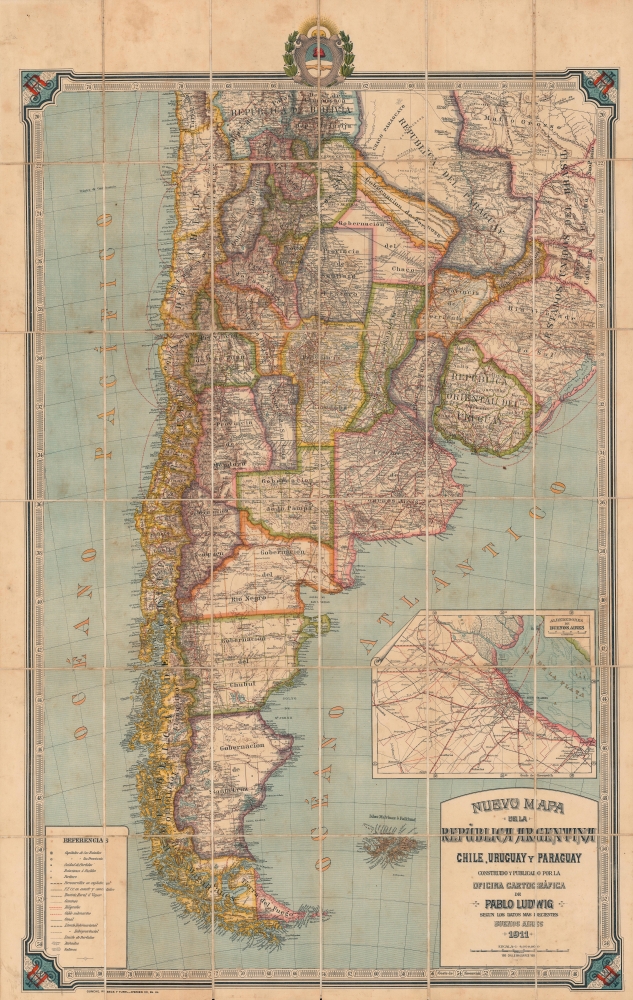
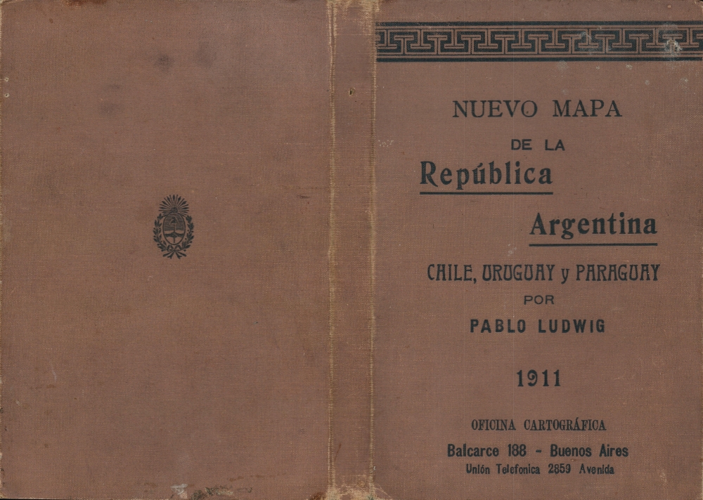
Nuevo Mapa de la República Argentina, Chile, Uruguay y Paraguay.
1911 (dated) 45 x 27.5 in (114.3 x 69.85 cm) 1 : 4000000
1911 (dated) 45 x 27.5 in (114.3 x 69.85 cm) 1 : 4000000
Description
A vividly-colored large-format 1911 folding map of southern South America (Argentina, Chile, Uruguay, and Paraguay), published in Buenos Aires by Pablo Ludwig. It depicts the region in the wake of large-scale immigration and expansion of infrastructure, especially in the vicinity of Buenos Aires and in the regions to the city's south.
A Closer Look
Focusing of Ludwig's home country of Argentina, colored outlines distinguish provinces and governorships. Portions or the entirety of neighboring countries - Uruguay, Paraguay, Chile, Brazil, and Bolivia, along with the disputed Falkland Islands - are also included with their own subdivisions also outlined, though in the same color (Yellow for Chile, Pink for Brazil, and so on). A legend at bottom-left explains symbols and lines indicating cities and other settlements, forts, rail lines (including those under construction and planned), roads, telegraph lines and undersea cables, wetlands, and salt flats. In contrast, the interior of Paraguay is notable for its paucity of information, mostly detailing former and contemporary religious missions. An inset towards bottom-right portrays the vicinity of Buenos Aires. An intricate border surrounds the map, with the initials of the República Argentina at the corners and the country's coat of arms at top.To the Ends of the Continent
This map was produced on the tail end of a period of territorial expansion and mass European immigration to Argentina. The regions south of Buenos Aires had hardly any European-descended settlers in 1850, but a successive process of conquest, infrastructure construction (ports, roads, and railways), and immigration transformed the landscape, with new arrivals establishing farms and pastures for livestock. The tremendous density of rail and trolley lines around Buenos Aires demonstrates where settlement was most dense, while Patagonia remained undeveloped and sparsely populated. In neighboring Chile, a similar process took place on a smaller scale in the Llanquihue Province and the Magallanes Territory. Despite a history of territorial disputes, economic motives promoted the linking of Argentina and Chile across the Andes, with a rail line between Mendoza and Santiago becoming operational in 1910, just one year before this map's publication.Publication History and Census
This map was designed and published by Pablo Ludwig and printed by Gunche, Wiebeck y Turtl in Buenos Aires in 1911. Ludwig published this folding map in editions from 1910 through 1919, all of which are quite rare now. We are only able to locate two examples of the 1911 edition in institutional collections, at the National Library of Australia and the Bibliothèque nationale de France.CartographerS
Pablo Ludwig (fl. c. 1890 - c. 1962) was cartographer active in Buenos Aires in the late 19th and early 20th centuries. His office, the Oficina Cartográfica de Pablo Ludwig, published maps of Buenos Aires, regional maps of Argentina, and maps of Argentina as a whole. We have been unable to discover anything about his personal life or a detailed history of his firm. More by this mapmaker...
Gunche, Wiebeck y Turtl (fl. c. 1892 - 1914), sometimes as Establecimiento Gráfico Gunche, Wiebeck y Turtl, was a printer based in Buenos Aires that was a frequent collaborator with Pablo Ludwig, the most prominent map publisher of the era in Argentina, if not South America as a whole. Little is known about the company and its work outside of the Ludwig maps, but they appear to have specialized in works relating to travel, geography, and history. Learn More...
Condition
Good. Mounted on original linen. Areas of wear and loss at fold intersections. Foxing present, especially along folds.
References
Rumsey 0447.001 (1914 Edition). OCLC 1126770729, 494260980.