
1827 Brue Dissected Atlas of the World

This item has been sold.
Atlas par H. Brue.
Exceptional boxed atlas.
- Digital Map Information
- Suitable for large format printing
- Full resolution TIFF file
- ICC color profile embedded
- Delivered instantly via download link
Exceptional boxed atlas.
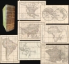
A remarkable cased 1827 atlas by Adrien-Hubert Brué. Housed in a handsome gilt-stamped leather case, the atlas features 8 dissected folding maps covering all parts of the world.A Closer Look
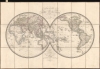
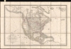
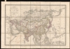
Individual maps include: Mappemonde (World Map), Europe, Asia, Océanie, Afrique, Amérique Nord, Amérique Sud, and France. The maps bear joint imprints from Europe's most prestigious map publishers, suggesting the maps were a joint work, including Andriveau-Goujon (Paris), Artaria (Manheim), Simon Schrop (Berlin), Riedl (Vienna), Zurich (Milan), Cary (London), and Betailli (Milan). The maps are of a uniform size, and are dissected and laid on linen in 21 sections, with tabs.Publication History and Census
While the separate maps occasionally appear in Brue's bound atlases, this case format, with the exceptional boxing, is rare.Cartographers
Adrien-Hubert Brué (March 20, 1786 – July 16, 1832) was a prominent French cartographer and geographer of the early 19th century. Born in Paris, Brué went to sea as a cabin boy at the age of twelve and, at fourteen, joined the Naturaliste, one of the two principal vessels of the Baudin Expedition (1800 - 1804) to the South Pacific. After returning to France, he devoted himself to cartography, earning distinction for the exceptional clarity, precision, and elegance of his maps. Brué drew many of his maps directly onto the copperplate, an innovative method he dubbed encyprotype. This technique produced exceptionally fine outlines, facilitated the careful revision of topography and relief, and allowed waterways to be differentiated by the weight of their engraved lines, making their relative importance immediately apparent. Brué eventually received the prestigious title Géographe du Roi, which he frequently appended to his signature, and in that capacity contributed to thousands of maps and numerous important atlases. Suffering from declining health, he retired to Sceaux, outside Paris, in search of cleaner air, but died there during the cholera epidemic of 1832. He was a member of the Central Commission of the Société de Géographie de Paris and an associate of the Geographical Society of London. Brué left numerous works unfinished at his death; several were published posthumously by his widow in 1834, before she transferred the business to Pierre-Jacques Picquet, son and successor of Brué's former associate Charles Picquet (1771 - 1827). Brué's maps continued to be revised and republished for decades, attesting to their enduring authority and commercial importance. Further Details...
Eugène Andriveau-Goujon (1832 - 1897) was a map publisher and cartographer active in 19th century Paris. The firm was created in 1825 when Eugène Andriveau married the daughter of map publisher Jean Goujon - thus creating Andriveau-Goujon. Maps by Andriveau-Goujon are often confusing to identify as they can be alternately singed J. Goujon, J. Andriveau, J. Andriveau-Goujon, E. Andriveau-Goujon, or simply Andriveau-Goujon. This refers to the multiple generations of the Andriveau-Goujon dynasty and the tendency to republish older material without updating the imprint. The earliest maps to have the Andriveau-Goujon imprint were released by Jean Andriveau-Goujon. He passed the business to his son Gilbert-Gabriel Andriveau-Goujon, who in 1858 passed to his son, Eugène Andriveau-Goujon, under whose management the firm was most prolific. Andriveau-Goujon published numerous fine pocket maps and atlases throughout the 19th century and often worked with other prominent French cartographers such as Adrien-Hubert Brué (1786 - 1832) and Victor Levasseur (1800 - 1870). The firm's stock was acquired by M. Barrère in 1892, who operated it until c. 1930, when it passed on to P.H. Barrère (presumably his son). In 1933, the firm was merged to become Girard et Barrère and in the post-World War II period operated as Girard, Barrère et Thomas until it was purchased by Cartes Taride in 1974. Further Details...
Jean Goujon (fl. c. 1785 - 1825) was a French publisher and mapseller based in Paris. Goujon's work begins appearing shortly before the French Revolution (1789 - 1799) and continues well into the Napoleonic Era (1799 - 1815). He was based out of no. 6, Rue du Bac, Paris. In 1825, Goujon's daughter married Eugène Andriveau. Andriveau soon took over Goujon's shop and took the name, Andriveau-Goujon. The family dynasty that followed became the most prominent geographic publishers in France in the 19th century. Further Details...
Condition
Very good. Original green leather with gilt stamping. Maps exhibit minor dampstaining, else clean. Size represents individual maps.