
Brué, Adrien-Hubert

Adrien-Hubert Brué (March 20, 1786 – July 16, 1832) was a prominent French cartographer and geographer of the early 19th century. Born in Paris, Brué went to sea as a cabin boy at the age of twelve and, at fourteen, joined the Naturaliste, one of the two principal vessels of the Baudin Expedition (1800 - 1804) to the South Pacific. After returning to France, he devoted himself to cartography, earning distinction for the exceptional clarity, precision, and elegance of his maps. Brué drew many of his maps directly onto the copperplate, an innovative method he dubbed encyprotype. This technique produced exceptionally fine outlines, facilitated the careful revision of topography and relief, and allowed waterways to be differentiated by the weight of their engraved lines, making their relative importance immediately apparent. Brué eventually received the prestigious title Géographe du Roi, which he frequently appended to his signature, and in that capacity contributed to thousands of maps and numerous important atlases. Suffering from declining health, he retired to Sceaux, outside Paris, in search of cleaner air, but died there during the cholera epidemic of 1832. He was a member of the Central Commission of the Société de Géographie de Paris and an associate of the Geographical Society of London. Brué left numerous works unfinished at his death; several were published posthumously by his widow in 1834, before she transferred the business to Pierre-Jacques Picquet, son and successor of Brué's former associate Charles Picquet (1771 - 1827). Brué's maps continued to be revised and republished for decades, attesting to their enduring authority and commercial importance.
One of the earliest large-format maps to illustrate the discoveries of Lewis and Clark.
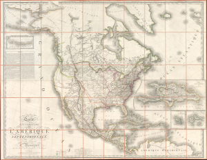
Carte Encyprotype de L'Amérique Septentrionale, Dédiée et présentée à Monsieur, Par M. Brué, Ingénieur-Géographe de S. A. Royale.
$6,500.00
Acquire
- Digital Map Information
- Suitable for large format printing
- File Size: 141.05 MB
- File Type: ZIP / TIFF
- ICC color profile embedded
- Delivered instantly via download link
This is the first edition of Adrien-Hubert Brué's 1815 map of North America, significant as one of the earliest publications to illustrate cartographically and in detail the achievements of the Lewis and Clark Expedition. (more details)
Highlights numerous Native American tribes in the American West, including the Sioux and Osage.
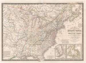
Carte Générale des États-Unis, des Haut et Bas-Canada, de la Nouvelle Ecosse, du Nouveau Brunswick, de Terre-Neuve, etc.
$200.00
Acquire
- Digital Map Information
- Suitable for large format printing
- DPI: 300
- File Size: 9.86 MB
- File Type: ZIP / TIFF
- ICC color profile embedded
- Delivered instantly via download link
This is an 1836 Adrien-Hubert Brué and Charles Picquet map of the United States. The map depicts the region from the Black Hills to the Atlantic Ocean and from Canada to Texas and the Gulf of Mexico. Beautifully engraved, myriad cities, towns, and villages are ... (more details)
The Caribbean in striking detail.
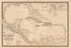
Carte Générale des Îles Antilles, des Îles et Bancs de Bahama, des États-Unis de l'Amérique-Centrale, de la Mer du Mexique, etc.
$900.00
Acquire
- Digital Map Information
- Suitable for large format printing
- File Size: 45.19 MB
- File Type: ZIP / TIFF
- ICC color profile embedded
- Delivered instantly via download link
This is a beautiful and wonderfully detailed Adrien-Hubert Brué and Charles Picquet 1845 map of the West Indies. Published 4 years after the Federal Republic of Central America ceased to exist, the map still illustrates that short-lived Central American republic. (more details)
French recognition of the Republic of Texas.
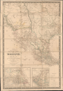
Nouvelle Carte du Mexique, du Texas et d'une partie des états limitrophes...
$6,000.00
Acquire
- Digital Map Information
- Suitable for large format printing
- Full resolution TIFF file
- ICC color profile embedded
- Delivered instantly via download link
This is the 1845 edition of Adrien-Hubert Brué's seminal map of Mexico and the Republic of Texas - issued at the peak of the Mexican-American War (1846 - 1848). Wheat rightly hails this as a 'most important map.' Its significance is as expansive as its coverage, ranging from up-to-date cartography regarding the Republic of Texas (and the French recognition thereof), to some of the first printed mappings of the cartography of Jedediah Smith, to one of the earliest uses of the term 'Arizona' on a printed map. (more details)