This item has been sold, but you can get on the Waitlist to be notified if another example becomes available.
1962 JRO-Sonderkarte Multilingual Pictorial City Map of Berlin, Germany
Berlin-jro-1962-2$137.50


Title
Berlin.
1962 (undated) 23.5 x 32.75 in (59.69 x 83.185 cm) 1 : 69120
1962 (undated) 23.5 x 32.75 in (59.69 x 83.185 cm) 1 : 69120
Description
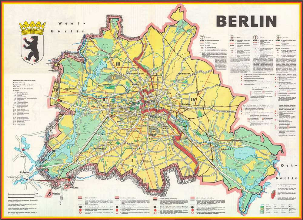
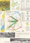
This is a 1962 JRO-Sonderkarte pictorial city map of Berlin, Germany. The map depicts East and West Berlin, with the recently constructed Berlin Wall dividing the city. Created within 18 months of the construction of the Berlin Wall, a certain undeniable Cold War cache defines the map. Here, West Berlin is encircled by barbed wire on three sides with the Berlin Wall completing its imprisonment on the fourth.
A Closer Look
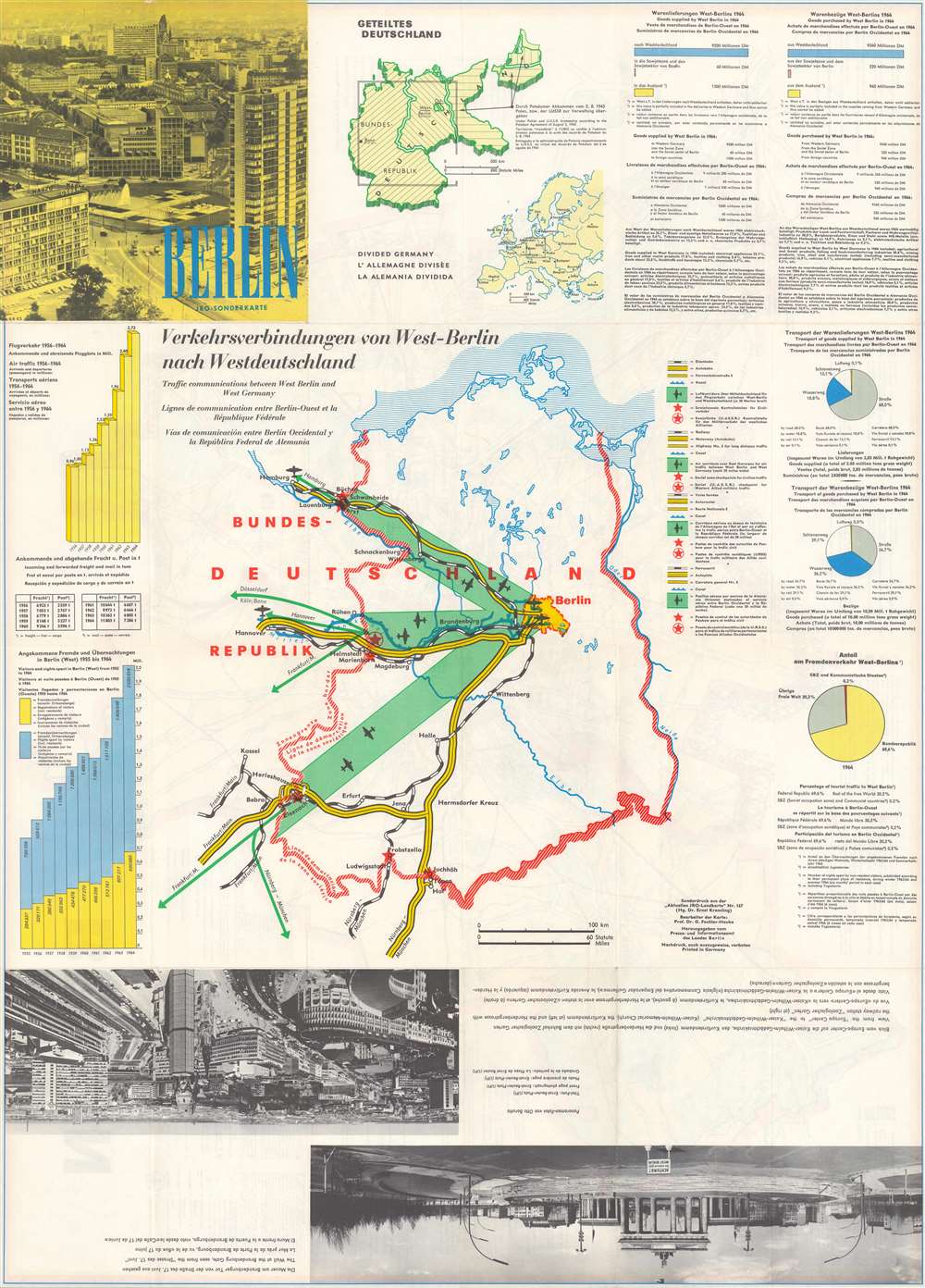
Sites throughout East and West Berlin are labeled, including both Tegel and Tempelhof Airports, both of which played a critical role in the Berlin Airlift conducted between 1948 and 1949. Neighborhoods in both East and West Berlin are labeled, such as Spandau and Charlottenburg. Twenty-one locations around West Berlin are illustrated in profile and numerically identified, including the Brandenburg Gate, which bisects the Wall. A corresponding index is included along the left border. Keys to the map are included on the right and below in German, English, French, and Spanish. Berlin's coat of arms is included in the upper left, and the whole is surrounded by a black, red, and yellow border: the colors of the German flag. A map of the Berlin Airlift and a photo of the Brandenburg Gate are included on the verso.Publication History
This map was produced by JRO-Sonderkarte in 1962.Condition
Very good. Light wear along original fold lines. Text, photographs, and a map illustrating communication lines between West Berlin and West Germany on verso.