1970 Carta Jerusalem Pictorial Tourist Map of Bethlehem, Israel
Bethlehem-cartajerusalem-1970$200.00


Title
Map of Bethlehem.
1970 (undated) 18 x 11.5 in (45.72 x 29.21 cm) 1 : 4400
1970 (undated) 18 x 11.5 in (45.72 x 29.21 cm) 1 : 4400
Description
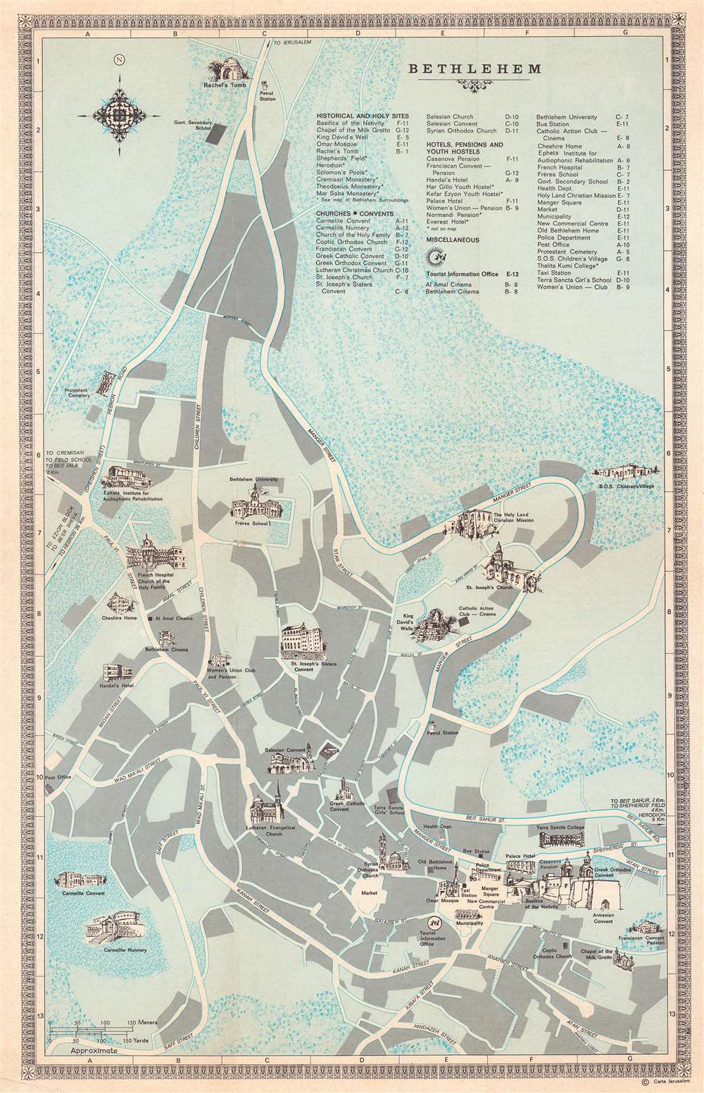
This is a 1970 Carta Jerusalem pictorial tourist map of Bethlehem, West Bank, Israel. Profile illustrations depict sites across the city, including the Basilica of the Nativity, the Chapel of the Milk Grotto, King David's Well, the Omar Mosque, and Rachel's Tomb. Several churches and convents are also illustrated in profile, along with schools, cinemas, and hotels. Important parts of modern society, including a taxi station, gas (petrol) stations, and the Health Department are identified as well.
Verso Content
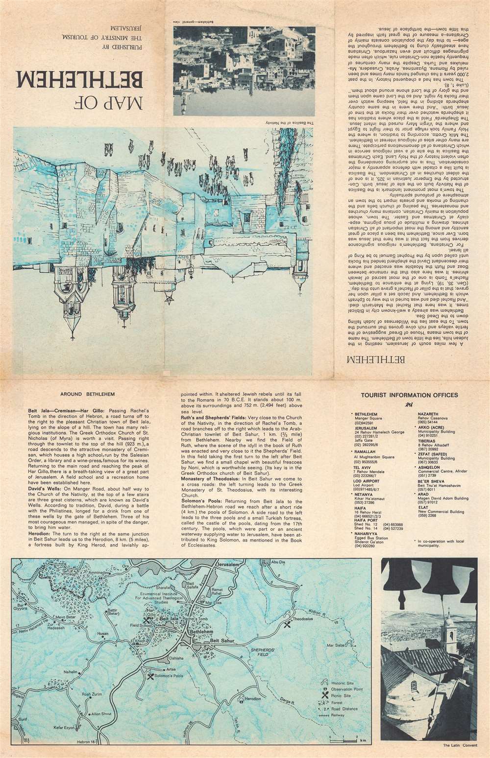
A map of the environs of Bethlehem occupies part of the verso and marks historic sites alongside picnic locations and smaller villages outside of town. Short descriptions of some of the sites appear on the verso as well, along with a short history of Bethlehem. Two photographs, one of Bethlehem and one of the Latin Convent, also are included.Publication History and Census
This map was created and copyrighted by Carta Jerusalem and published by the Ministry of Tourism in 1970. We note one example cataloged in OCLC, at Brigham Young University.Condition
Very good. Light wear along original fold lines.
References
OCLC 890201591.